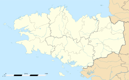
Guer
|
Guer Gwern-Porc'hoed |
||
|---|---|---|

Saint Nicolas chapel near Guer
|
||
|
||
| Coordinates: 47°54′17″N 2°07′09″W / 47.9047°N 2.1192°WCoordinates: 47°54′17″N 2°07′09″W / 47.9047°N 2.1192°W | ||
| Country | France | |
| Region | Brittany | |
| Department | Morbihan | |
| Arrondissement | Vannes | |
| Canton | Guer | |
| Intercommunality | Pays de Guer | |
| Government | ||
| • Mayor (2008—2014) | Jean-Luc Bléher | |
| Area1 | 52.11 km2 (20.12 sq mi) | |
| Population (1999)2 | 5,560 | |
| • Density | 110/km2 (280/sq mi) | |
| Time zone | CET (UTC+1) | |
| • Summer (DST) | CEST (UTC+2) | |
| INSEE/Postal code | 56075 /56380 | |
| Elevation | 18–155 m (59–509 ft) (avg. 50 m or 160 ft) |
|
|
1 French Land Register data, which excludes lakes, ponds, glaciers > 1 km² (0.386 sq mi or 247 acres) and river estuaries. 2Population without double counting: residents of multiple communes (e.g., students and military personnel) only counted once. |
||
1 French Land Register data, which excludes lakes, ponds, glaciers > 1 km² (0.386 sq mi or 247 acres) and river estuaries.
Guer (Breton: Gwern-Porc'hoed) is a commune in the Morbihan department in Brittany in north-western France.
It is located at the edge of the famous Brocéliande Forest, which is the setting of the Round Table novels in Brittany. It is 43 km (27 mi) southwest from Rennes, the regional capital.
Camp Coëtquidan (Camp de Coëtquidan) is located in Guer and comprises three military educational facilities:
Inhabitants of Guer are called Guerrois.
...
Wikipedia


