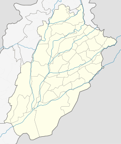
Gujarkhan
|
Gujar Khan گوجر خان |
|
|---|---|
| City | |
| Gujar Khan | |
| Coordinates: 33°15′11″N 73°18′14″E / 33.253°N 73.304°ECoordinates: 33°15′11″N 73°18′14″E / 33.253°N 73.304°E | |
| Country | Pakistan |
| Province | Punjab |
| District | Rawalpindi |
| Area | |
| • Total | 1,466 km2 (566 sq mi) |
| Elevation | 461 m (1,512 ft) |
| Population (1998) | |
| • Total | 57,152 |
| • Density | 49.7/km2 (129/sq mi) |
| Time zone | PST (UTC+5) |
| Calling code | 0513 |
| Number of Union councils | 36 |
| 0 | |
Gujar Khan (Punjabi/Urdu: گوجر خان) is a city in Rawalpindi District, Punjab, Pakistan. It is the headquarters of Gujar Khan Tehsil, and the largest tehsil of Punjab by land area.
Gujar Khan is approximately 55 kilometres southeast of Islamabad, the capital of Pakistan and 220 km to the north west of Lahore, capital of Punjab. It is bounded on the north by Rawalpindi, Islamabad and , on the south by Jhelum, Lahore and Gujrat, on the east by Azad Kashmir and Kahuta and on the west by Chakwal and Khushab.
Located in the heart of the Potohar region, The city and surrounding region is renowned for its martial culture and is sometimes referred to as the 'Land of the Shaheed', having produced two recipients of the Nishan-i-Haider.
There is a main district hospital in the center of the city, along with many other private and public medical and care services.
The place was named after the Gujar. who were the rulers of the Gurjara-Pratihara Kingdom, ruling for centuries during the late classical period.
The Delhi Sultanate and later Mughal Empire ruled the region. The Punjab region became predominantly Muslim during this time primarily due to Sufi saints whose dargahs dot the landscape of Punjab region. The Mughal Empire later fell into a deep decline at which point the Sikh Empire invaded and occupied Rawalpindi District. Eventually the Sikh Empire collapsed and the British began direct rule in the region until independence in 1947.
...
Wikipedia


