Gurskøya
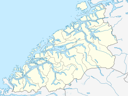
| Location in Møre og Romsdal] | |
| Geography | |
|---|---|
| Location | Norway |
| Coordinates | 62°14′N 05°44′E / 62.233°N 5.733°ECoordinates: 62°14′N 05°44′E / 62.233°N 5.733°E |
| Area | 137 km2 (53 sq mi) |
| Length | 11 km (6.8 mi) |
| Width | 16.5 km (10.25 mi) |
| Highest elevation | 660 m (2,170 ft) |
| Highest point | Sollia |
| Administration | |
| County | Møre og Romsdal |
| District | Sunnmøre |
| Municipalities | Herøy and Sande |
Gurskøya or Gurskøy is an island in Møre og Romsdal county, Norway. The 137-square-kilometre (53 sq mi) island is shared by the municipalities of Sande and Herøy. The villages of Gursken, Larsnes, and Moldtustranda are located on the island. The southern part of the island was historically part of the municipality of Rovde.
The island lies north of the Rovdestranda area on the mainland; southwest of the islands of Hareidlandet and Dimnøya, west of the island of Eika; east of the islands of Kvamsøya, Voksa, and Sandsøya; and south of the Norwegian Sea.
The island is home to many fish-related industries such as fishing and fish processing.
...
Wikipedia

