Hafslo (village)
| Hafslo | |
|---|---|
| Village | |

View of the village
|
|
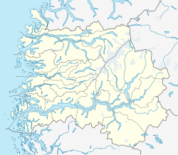
| Location in Sogn og Fjordane county | |
| Coordinates: 61°18′55″N 07°12′03″E / 61.31528°N 7.20083°ECoordinates: 61°18′55″N 07°12′03″E / 61.31528°N 7.20083°E | |
| Country | Norway |
| Region | Western Norway |
| County | Sogn og Fjordane |
| District | Sogn |
| Municipality | Luster Municipality |
| Area | |
| • Total | 0.25 km2 (0.10 sq mi) |
| Elevation | 181 m (594 ft) |
| Population (2013) | |
| • Total | 457 |
| • Density | 1,828/km2 (4,730/sq mi) |
| Time zone | CET (UTC+01:00) |
| • Summer (DST) | CEST (UTC+02:00) |
| Post Code | 6869 Hafslo |
Hafslo is a village in Luster Municipality in Sogn og Fjordane county, Norway. The village is located on the northern shore of the lake Hafslovatnet, about 3 kilometres (1.9 mi) northwest of the village of Solvorn which sits on the shores of the Lustrafjorden. The lake Veitastrondvatnet is located to the northwest of Hafslo. The village of Sogndalsfjøra lies 15 kilometres (9.3 mi) to the south; the village of Gaupne lies about 15 kilometres (9.3 mi) to the north; and the village of Veitastrond lies about 25 kilometres (16 mi) to the northwest. The Norwegian County Road 55 runs through the village on its way from Sogndalsfjøra to Gaupne. The 0.25-square-kilometre (62-acre) village has a population (2013) of 457, giving the village a population density of 1,828 inhabitants per square kilometre (4,730/sq mi).
Historically, the village of Hafslo was the administrative centre of the municipality of Hafslo, which existed from 1838 until 1963. Hafslo Church, located in the village of Hafslo, was the main church for the municipality, and it still is the main church for the Hafslo parish.
The name comes from the old Hafslo farm (Old Norse: Hafrsló), since Hafslo Church was located there. The first element of the name comes from the old male name Hafr or from the word for "goat" (also hafr). The second element of the name comes from the old word ló meaning "meadow", probably due to the excellent farming areas nearby.
...
Wikipedia


