Halawa, Hawaii
| Halawa, Hawaii | |
|---|---|
| Census-designated place | |

Interstate H-3 in Halawa Valley looking towards the Koʻolau crest
|
|
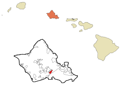
 Location in Honolulu County and the state of Hawaii |
|
| Coordinates: 21°22′39″N 157°55′22″W / 21.37750°N 157.92278°WCoordinates: 21°22′39″N 157°55′22″W / 21.37750°N 157.92278°W | |
| Country | United States |
| State | Hawaii |
| Area | |
| • Total | 2.3 sq mi (6.0 km2) |
| • Land | 2.3 sq mi (6.0 km2) |
| • Water | 0.0 sq mi (0.0 km2) |
| Elevation | 177 ft (54 m) |
| Population (2010) | |
| • Total | 14,014 |
| • Density | 6,100/sq mi (2,300/km2) |
| Time zone | Hawaii-Aleutian (UTC-10) |
| Area code(s) | 808 |
| FIPS code | 15-10000 |
| GNIS feature ID | 1867251 |
Halawa is a census-designated place (CDP) in the ‘Ewa District of Honolulu County, Hawaii, United States. Halawa Stream branches into two valleys: North and South Halawa; North Halawa is the larger stream and fluvial feature. Their confluence is within the H-3/H-201 highways exchange. Most of Halawa Valley is undeveloped. As of the 2010 Census, the CDP had a population of 14,014.
The entire ahupuaʻa of Halawa is highly sacred to Kanaka Maoli. At the far Makai (ocean) side at Puʻuloa or Pearl Harbor, it is, according to Kanaka Maoli beliefs, the home of the shark goddess Kaʻahupahau, known as the "Queen of Sharks", who protected Oʻahu and strictly enforced kind, fair behavior on the part of both sharks and humans. Until the late 1890s, the home of Kaʻahupahau was famously lined with beds of pearl oysters, however, according to Kanaka Maoli religious experts who follow the goddess, Kaʻahupahau removed all of the oysters (and some say, herself) because the area was being abused by human misdeeds. Today, the water of Pearl Harbor has been highly contaminated by nuclear defueling and other toxic influences, and has thereby been designated as a Superfund site.
The upland, or Mauka, portion of Halawa is sacred to Papahānaumoku, the Kanaka Maoli form of Mother Earth, as it is, according to legend, her birthplace and primary home, as well as one of only two or three known remaining Hale o Papa, womenʻs temples where Papa is worshipped. The valley contains many religious and other cultural sites sacred to Kanaka Maoli. Although many sites were destroyed by the invasion of Kahekili II and especially by the building of the highly controversial H-3 Freeway, many remain and are cared for by Kanaka Maoli Aloha ʻAina practitioners to this day.
In the last two decades, North Halawa has been the site of a very public battle over the religious sites and ecological resources destroyed by H-3, which is the most expensive freeway per mile in human history. At least two species were driven to probable extinction (none have been sighted since construction began), many more are declining rapidly, the main aquifer of the area was badly damaged, and religious sites were seriously impacted. Although the freeway was opened in 1997, many are still fighting for mitigation of these impacts, and some are asking for the freewayʻs closure. In 1993, thirteen cultural practitioners were arrested while conducting a ceremony to pray for the healing of the valley. Their lele (religious altar) was destroyed, and the caretakers of the area were barred from entrance to the sites. Today, some of these caretakers, many of them kupuna (elders), have returned to care for the sites, although they now do so through a layer of soot and with the roar of the freeway as a constant sonic backdrop. Many kanaka maoli do not use the freeway because of these impacts, and because of the lasting belief that the road is haunted—an often-attributed explanation for the high accident rate on the freeway (more generally believed to be caused by the high speeds often used by the motorists who traverse it).
...
Wikipedia
