Halfmoon, New York
| Halfmoon, New York | ||
|---|---|---|
| Town | ||

The Thaddeus Kosciusko Bridge connects Halfmoon in Saratoga County to Colonie in Albany County, New York, over the Mohawk River.
|
||
|
||
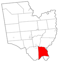
 Location within Saratoga County |
||
| Location within the state of New York | ||
| Coordinates: 42°51′24″N 73°44′33″W / 42.85667°N 73.74250°WCoordinates: 42°51′24″N 73°44′33″W / 42.85667°N 73.74250°W | ||
| Country | United States | |
| State | New York | |
| County | Saratoga | |
| Area | ||
| • Total | 33.7 sq mi (87.2 km2) | |
| • Land | 32.6 sq mi (84.6 km2) | |
| • Water | 1.0 sq mi (2.6 km2) | |
| Elevation | 282 ft (86 m) | |
| Population (2010) | ||
| • Total | 21,535 | |
| • Density | 565.9/sq mi (218.5/km2) | |
| Time zone | Eastern (EST) (UTC-5) | |
| • Summer (DST) | EDT (UTC-4) | |
| ZIP code | 12065 | |
| Area code(s) | 518 | |
| FIPS code | 36-31489 | |
| GNIS feature ID | 0979035 | |
Halfmoon is a town in Saratoga County, New York, United States. The population was 21,535 at the 2010 census. The town is named for the Dutch ship of the same name which sailed the Hudson River and Mohawk River.
Halfmoon is in the southeast part of the county and is north of Albany.
The earliest settlements occurred around 1680 by the Mohawk River.
The town was formed while still part of Albany County in 1788. The name was briefly changed to “Orange” when the town of Waterford was created in 1816 from part of Halfmoon, but the current name was restored in 1820. In 1828, the western portion of the town was used to create the town of Clifton Park.
The Erie Canal was built along the south part of Half Moon, part of the Mohawk River.
According to the United States Census Bureau, the town has a total area of 33.7 square miles (87 km2), of which, 32.7 square miles (85 km2) of it is land and 1.0 square mile (2.6 km2) of it (3.00%) is water.
The south town line, delineated by the Mohawk River, is the border of Albany County. The east town line, at the Hudson River, is the border of Rensselaer County. The north town line is marked by Anthony Kill, a tributary of the Hudson River.
Interstate 87, the Adirondack Northway, is a six-lane north-south freeway along the western edge of Halfmoon. U.S. Route 9 parallels the interstate farther to the east and crosses into the town from Albany County on the Crescent Bridge. New York State Route 146, an east-west highway, intersects US-9 at the hamlet of Clifton Park. U.S. Route 4 is a north-south highway in the eastern part of the town. New York State Route 236 is a short state highway linking NY-146 to US-9.
...
Wikipedia


