Harris Neck Army Airfield
| Harris Neck Army Airfield Harris Neck OLF |
|
|---|---|
| McIntosh County, Georgia, USA | |

US Geological Survey aerial photo in 2006
|
|
| Coordinates | 31°38′24″N 081°17′24″W / 31.64000°N 81.29000°WCoordinates: 31°38′24″N 081°17′24″W / 31.64000°N 81.29000°W |
| Type | Military airfield |
| Site information | |
| Owner | U.S. Fish & Wildlife Service |
| Controlled by | First Air Force |
| Condition | Abandoned |
| Site history | |
| Built | 1942 |
| In use | 1942-1944 |
| Battles/wars | World War II |
| Garrison information | |
| Garrison | 85th Fighter-Bomber Group |
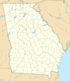
Harris Neck Army Airfield is an abandoned military airfield located in what is now the Harris Neck National Wildlife Refuge, McIntosh County, Georgia. It is located north of the intersection of Route 131 and Harris Neck Airport Road, about 30 miles (48 km) southwest of Savannah, Georgia.
Harris Neck is a coastal peninsula located 30 miles (48 km) south of Savannah, Georgia in McIntosh County. The nearest town is South Newport, six miles (10 km) to the west. Originally named Dickinson's Neck, the peninsula was renamed when William Thomas Harris became the principal land owner in the mid 18th century.
The original Harris Neck airfield was built in 1930 and leased from Courtney Thorpe by the US Dept. of Commerce. It was named "Harris Neck Intermediate Field Site #8", it was an emergency airfield for commercial and airmail planes on the Richmond-Jacksonville air route. The field consisted of a cross-shaped 93-acre (380,000 m2) sod parcel, with two sod runways 2,600' east/west & 2,550' north/south. The emergency field was illuminated and included an 81 foot tall beacon tower, but offered only emergency services to pilots. Harris Neck Site 8 airfield was secured by an army detachment from Hunter airfield in Savannah on Dec. 7, 1941 and closed to the public on 1 January 1942 when the Civil Air Patrol began anti-submarine flights. It was closed for military use in 1943 when the new expanded military airfield was opened a half-mile north. There is no trace of the CAA airfield existence today but its outline by property fencing on the southern boundary.
In mid-1942, the Army Air Force decided to build a base at Harris Neck. The land was expropriated and families were given two weeks to remove themselves. At the time of transfer the black families (who owned 1,102 acres) were given an average of $26.90 per acre and the white families (who owned 1,532 acres) were given an average of $37.31 per acre. This included the 225-acre (0.91 km2) Livingston estate which included the Lorillard mansion and a deep-water dock. Construction was started on 15 July 1942 by the United States Army Air Forces First Air Force. The original plan provided for two runways. The Army's decision to add a third runway required the acquisition of additional land. A detachment of men from the 855th Guard Squadron, stationed at Hunter Army Air Field occupied the Harris Neck facility on 7 December 1942. It was activated on 28 January 1943 as an auxiliary of Dale Mabry Army Airfield in Tallahassee, Florida.
...
Wikipedia


