Hartsville, South Carolina
| Hartsville, South Carolina | ||
|---|---|---|
| City | ||
|
||
| Motto: "A small town with a big heart" | ||
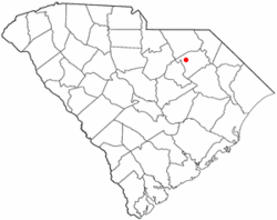
 Location of Hartsville, South Carolina |
||
| Coordinates: 34°22′10″N 80°4′51″W / 34.36944°N 80.08083°WCoordinates: 34°22′10″N 80°4′51″W / 34.36944°N 80.08083°W | ||
| Country | United States | |
| State | South Carolina | |
| County | Darlington | |
| Area | ||
| • Total | 6.2 sq mi (16.0 km2) | |
| • Land | 5.7 sq mi (14.8 km2) | |
| • Water | 0.4 sq mi (1.1 km2) | |
| Elevation | 217 ft (66 m) | |
| Population (2010) | ||
| • Total | 7,764 | |
| • Density | 1,357/sq mi (523.8/km2) | |
| Time zone | Eastern (EST) (UTC-5) | |
| • Summer (DST) | EDT (UTC-4) | |
| ZIP codes | 29550, 29551 | |
| Area code(s) | 843, 854 | |
| FIPS code | 45-32560 | |
| GNIS feature ID | 1231367 | |
| Website | www |
|
Hartsville is the largest city in Darlington County, South Carolina, United States. The population was 7,764 at the 2010 census. Mel Pennington is the current mayor. Hartsville was chosen as an All-America City in 1996 and again in 2016. Hartsville has also been a National Arbor Day Foundation Tree City since 1986.
Hartsville is the home of Coker College and a branch of Florence–Darlington Technical College. It is also the site of the South Carolina Governor's School for Science and Mathematics, a public boarding high school.
The city is served by the Hartsville Regional Airport.
Hartsville is home to several major corporations including Sonoco Products Company and Duke Energy Progress. Agrium Inc. maintained a Rainbow Fertilizer plant in Hartsville until it was destroyed by fire on February 14, 2011. Agrium has chosen not to rebuild in Hartsville.
The area surrounding Hartsville was once home to several Native American tribes, including the Pee Dee, Catawba, Chicora, Edisto, Sane, and Chicora-Waccamaw, who inhabited the region until European settlers arrived. The tribes were ultimately wiped out due to diseases brought in by settlers.
Hartsville's first settlement began around 1760. The town is named for Captain Thomas E. Hart, who eventually owned most of the land in the community. Hart started a successful mercantile business, but he lost his business and his land during the economic depression of 1837–1838.
In 1845, Thomas Hart's son, John Lide Hart, purchased 495 acres (200 ha) of land in what is now downtown Hartsville from Colonel Law. John Hart went on to establish a carriage factory, steam-powered saw mill, grist mill, general store, and Hartsville Baptist Church. Caleb Coker purchased the carriage factory for his son James Lide Coker in 1855.
...
Wikipedia

