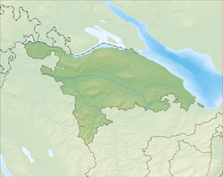
Herdern
| Herdern | ||
|---|---|---|

The inn "Löwen", in Herdern
|
||
|
||
| Coordinates: 47°36′N 8°54′E / 47.600°N 8.900°ECoordinates: 47°36′N 8°54′E / 47.600°N 8.900°E | ||
| Country | Switzerland | |
| Canton | Thurgau | |
| District | Frauenfeld | |
| Area | ||
| • Total | 13.67 km2 (5.28 sq mi) | |
| Elevation | 412 m (1,352 ft) | |
| Population (Dec 2015) | ||
| • Total | 1,020 | |
| • Density | 75/km2 (190/sq mi) | |
| Postal code | 8535 | |
| SFOS number | 4811 | |
| Surrounded by | Homburg, Hüttwilen, Mammern, Pfyn, Warth-Weiningen | |
| Website |
www SFSO statistics |
|
Herdern is a municipality in Frauenfeld District in the canton of Thurgau in Switzerland.
Herdern is first mentioned in 1094 as Harderin. Originally it was under the authority of Ittingen. Until 1403 the local castle, Herden Castle, was home to the Bettler family. In 1501, the low court of Herdern was combined with the lands of Herden Castle to form the Herrschaft of Herdern. In 1601 the castle was expanded and renovated. In 1683 the castle and Herrschaft came to the monastery of St. Urban in Lucerne. The low court was managed until 1798 by the monastery's resident governor who occupied the castle. The castle belonged to the monastery of St. Urban until 1848 when it was sold. After passing through several owners it was acquired by the Verein Arbeiterkolonien Herden (Association of the Work Camps of Herdern). They opened the castle in 1895 as a home for unemployed workers, ex-prisoners and vagrants. In 1995 the castle became a home for those with psychological and social problems (it had 75 inhabitants in 2003).
The parish boundaries were very similar to the Herrschaft lands. In 1331 the church rights and taxes went to the monastery at Kalchrain. When the Protestant Reformation entered the village in 1529, the local nobility remained by the old religion, and in 1533 Kalchrain sent a priest to support the nobility. The parish remained Catholic.
Until the 19th Century the major sources of income in Herdern were grain, wine and fruit production. These remained important even after a cloth factory and a lignite mine opened. Towards the end of the 19th Century, livestock production and dairy farming began to move into the village.
Herdern has an area, as of 2009[update], of 13.67 square kilometers (5.28 sq mi). Of this area, 9.21 km2 (3.56 sq mi) or 67.4% is used for agricultural purposes, while 3.84 km2 (1.48 sq mi) or 28.1% is forested. Of the rest of the land, 0.61 km2 (0.24 sq mi) or 4.5% is settled (buildings or roads) and 0.02 km2 (4.9 acres) or 0.1% is unproductive land.
...
Wikipedia


