Hiawatha National Forest
| Hiawatha National Forest | |
|---|---|
|
IUCN category VI (protected area with sustainable use of natural resources)
|
|

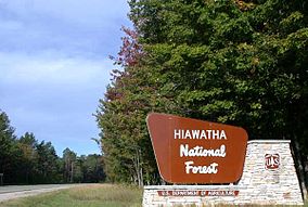
Road sign of the Hiawatha National Forest in Alger County
|
|
| Location | Upper Peninsula, Michigan, United States |
| Nearest city | Escanaba, MI |
| Coordinates | 46°08′N 86°40′W / 46.133°N 86.667°W |
| Area | 894,836 acres (3,621.27 km2) |
| Established | January 16, 1931 |
| Governing body | U.S. Forest Service |
| Website | Hiawatha National Forest |
Hiawatha National Forest is a 894,836-acre (362,127 ha) National Forest in the Upper Peninsula of the state of Michigan in the United States. Commercial logging is conducted in some areas. The United States Forest Service administers this National Forest; it is physically divided into two subunits, commonly called the Eastside 46°14′N 84°50′W / 46.233°N 84.833°W and Westside 46°08′N 86°40′W / 46.133°N 86.667°W. In descending order of land area it lies in parts of Chippewa, Delta, Mackinac, Alger, Schoolcraft, and Marquette counties. Chippewa and Mackinac counties are in the Eastside, whereas the rest are in the Westside. The smaller Eastside contains about 44% of the forest's area, whereas the larger Westside has about 56%. Forest headquarters are located in Escanaba, Michigan. Eastside ranger district offices are located in Sault Ste. Marie and St. Ignace, while Westside offices are in Manistique, Munising, and Rapid River.
...
Wikipedia

