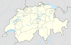
Hinderi Schibe
| Schibe | |
|---|---|
| Highest point | |
| Peak | Hinderi Schibe |
| Elevation | 3,083 m (10,115 ft) |
| Prominence | 124 m (407 ft) |
| Parent peak | Tödi |
| Coordinates | 46°49′07″N 8°58′18″E / 46.81861°N 8.97167°ECoordinates: 46°49′07″N 8°58′18″E / 46.81861°N 8.97167°E |
| Geography | |
| Country | Switzerland |
| Canton | Glarus |
| Parent range | Glarus Alps |
| Topo map | Swiss Federal Office of Topography swisstopo |
The Schibe is a mountain of the Glarus Alps, located south of Linthal in the canton of Glarus. It lies north of the , on the range separating the Sand valley from the Limmeren valley that also includes the Selbsanft.
The mountain is composed of two summits: the Hinderi Schibe at an elevation of 3,083 m (10,115 ft) and the Vorderi Schibe at an elevation of 2,987 m (9,800 ft). The mountain lies within the municipality of Glarus Süd. In a broader sense, they are part of the Selbsanft massif.
...
Wikipedia

