Hoylake
| Hoylake and Meols | |
|---|---|
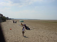
 Hoylake beach, looking towards Hilbre Island |
|
| Hoylake and Meols shown within Merseyside | |
| Population | 13,348 2011 Census.Ward |
| OS grid reference | SJ215888 |
| • London | 183 mi (295 km) SE |
| Metropolitan borough | |
| Metropolitan county | |
| Region | |
| Country | England |
| Sovereign state | United Kingdom |
| Post town | WIRRAL |
| Postcode district | CH47 |
| Dialling code | 0151 |
| ISO 3166 code | GB-WRL |
| Police | Merseyside |
| Fire | Merseyside |
| Ambulance | North West |
| EU Parliament | North West England |
| UK Parliament | |

The old upper lighthouse
|
|
| Location | Hoylake Merseyside England |
|---|---|
| Coordinates | 53°23′32″N 3°10′57″W / 53.392089°N 3.182614°W |
| Year first constructed | 1764 (first) |
| Year first lit | 1865 (current) |
| Deactivated | 1886 |
| Construction | brick tower |
| Tower shape | octagonal prism tower with balcony and lantern attached to 2-storey keeper’s house |
| Markings / pattern | unpainted tower, black balcony, white lantern |
| Height | 17 metres (56 ft) |
| ARLHS number | ENG-055 |
| Managing agent | private |
Hoylake is a seaside town within the Metropolitan Borough of Wirral, Merseyside, England. The town is located at the north western corner of the Wirral Peninsula, near to the town of West Kirby and where the River Dee estuary meets the Irish Sea. The Peninsula was part of the historic county of Cheshire, at the time of the Domesday it was within the Hundred of Wilaveston.
At the 2001 census, the population of Hoylake was 5,710 of a total population of 13,042, as part of the Hoylake & Meols local government ward. By the time of the 2011 Census population figures for Hoylake were no longer maintained. However figures do exist for the ward of Hoylake and Meols. The total population at this Census was 13,348.
In 1690, William III set sail from Hoylake, then known as Hyle or High-lake, with a 10,000-strong army to Ireland, where his army was to take part in the Battle of the Boyne. The location of departure remains known as King's Gap. The previous year a large force under Marshal Schomberg had also departed from Hoylake on 12 August, crossing to Ireland to capture Carrickfergus.
The present day township grew up in the 19th century around the small fishing village of Hoose. The name Hoylake was derived from Hoyle Lake, a channel of water between Hilbre Island and Dove Point. Protected by a wide sandbank known as Hoyle Bank and with a water depth of about 20 feet, it provided a safe anchorage for ships too large to sail up the Dee to Chester.
...
Wikipedia

