Humboldt Redwoods State Park
| Humboldt Redwoods State Park | |
|---|---|

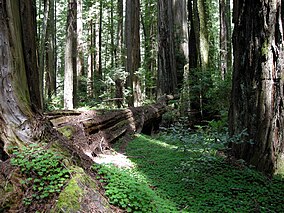
The "darkness at noon" effect is synonymous with redwood groves
|
|
| Location | Humboldt County, California, USA |
| Nearest city | Rio Dell, California |
| Coordinates | 40°18′43″N 123°58′18″W / 40.31194°N 123.97167°WCoordinates: 40°18′43″N 123°58′18″W / 40.31194°N 123.97167°W |
| Area | 51,651 acres (209.02 km2) |
| Established | 1921 |
| Governing body | California Department of Parks and Recreation |
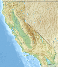
Humboldt Redwoods State Park is a state park of California, United States, containing Rockefeller Forest, the world's largest remaining contiguous old-growth forest of coast redwoods. It is located 30 miles (48 km) south of Eureka, California, near Weott in southern Humboldt County, within Northern California, named after the great nineteenth-century scientist, Alexander von Humboldt. The park was established by the Save-the-Redwoods League in 1921 largely from lands purchased from the Pacific Lumber Company. Beginning with the dedication of the Raynal Bolling Memorial Grove, it has grown to become the third-largest park in the California State Park system, now containing 51,651 acres (20,902 ha) through acquisitions and gifts to the state.
It is part of the Northern California coastal forests ecoregion and has 23,600 acres (96 km2) of old-growth forests. 17,000 acres (69 km2) are old-growth redwoods, comprising the entire Bull Creek watershed and the Rockefeller Forest.
Nearby U.S. Route 101, which generally follows the Eel River and its South Fork in this part of the North Coast, offers easy access to the park and nearby towns with connections to the scenic highway, Avenue of the Giants, also mostly located within or near park boundaries.
...
Wikipedia


