Hurricane Cora (1978)
| Category 1 hurricane (SSHWS/NWS) | |

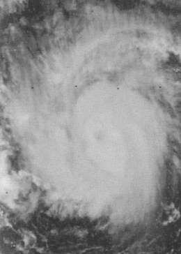
Hurricane Cora shortly after reaching hurricane strength.
|
|
| Formed | August 7, 1978 |
|---|---|
| Dissipated | August 12, 1978 |
| Highest winds |
1-minute sustained: 90 mph (150 km/h) |
| Lowest pressure | 980 mbar (hPa); 28.94 inHg |
| Fatalities | 1 direct |
| Damage | Minimal |
| Areas affected | Windward Islands, St. Lucia, Barbados, Grenada |
| Part of the 1978 Atlantic hurricane season | |
Hurricane Cora was the first tropical cyclone of the 1978 Atlantic hurricane season to reach hurricane strength. Forming from a disturbance that exited the African coast on August 7, the storm moved at an unusually high forward speed for a cyclone in the Atlantic Ocean in August. The storm later reached hurricane strength and formed a well-defined eye that lasted only 12 hours before the eye rapidly lost organization for unknown reasons, though the post-season report on the storm mentions the possibility that its high speed caused the eye to dissipate. The storm moved west-southwestward, weakening before making landfall on the island of Grenada. The storm lost its circulation and became a tropical wave on August 12. The remnant crossed over Central America into the Pacific Ocean, where it reintensified, becoming Hurricane Kristy.
Cora was an unusual cyclone, maintaining an unusually low latitude for the Atlantic in August at high speeds, similar to the tracks of Tropical Storm Alma in 1974 and Tropical Storm Fran in 1990. The hurricane was also upgraded into a hurricane based solely on satellite photography, the second time this occurred. Although it passed through the Windward Islands and the Lesser Antilles, only minor effects were reported. Cora was also responsible for altering weather conditions allowing for a takeoff of the historical flight of the Double Eagle II hot air balloon.
In early August, a disturbance was observed in satellite images moving off the coast of Africa on August 4. Moving westward along the Intertropical Convergence Zone at a forward speed of roughly 20 mph (32 km/h), the disturbance showed no signs of development until a cloud mass broke away from the ITCZ on August 6. The separated mass began rapidly organizing, becoming Tropical Depression Three late on August 7. The tropical depression continued to gain organization and was upgraded to a tropical storm on August 8, receiving the name Cora.
...
Wikipedia
