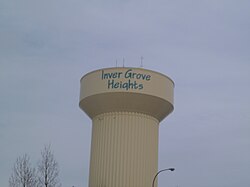
Inver Grove Heights, Minnesota
| Inver Grove Heights, Minnesota | |
|---|---|
| City | |
| City of Inver Grove Heights | |
 |
|
| Nickname(s): The Grove | |
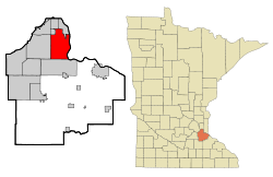
 Location of the city of Inver Grove Heights within Dakota County, Minnesota |
|
| Coordinates: 44°50′15″N 93°3′6″W / 44.83750°N 93.05167°W | |
| Country | United States |
| State | Minnesota |
| County | Dakota |
| Area | |
| • Total | 30.12 sq mi (78.01 km2) |
| • Land | 27.76 sq mi (71.90 km2) |
| • Water | 2.36 sq mi (6.11 km2) |
| Elevation | 879 ft (268 m) |
| Population (2010) | |
| • Total | 33,880 |
| • Estimate (2015) | 34,857 |
| • Density | 1,220.5/sq mi (471.2/km2) |
| Time zone | Central (CST) (UTC-6) |
| • Summer (DST) | CDT (UTC-5) |
| ZIP codes | 55076, 55077 |
| Area code(s) | 651 |
| FIPS code | 27-31076 |
| GNIS feature ID | 0645437 |
| Website | City of Inver Grove Heights |
Inver Grove Heights is a city in Dakota County, Minnesota, United States. The population was 33,880 at the 2010 census.
It is one of 186 cities and townships in the seven-county Minneapolis-Saint Paul metropolitan area.
Inver Grove Heights is 9 miles (14 km) southeast of Saint Paul; nearby communities are South St. Paul, West St. Paul, Sunfish Lake, Eagan, Newport, and Saint Paul Park (the last two across the Mississippi River).
After the signing of the Treaty of Traverse des Sioux in 1851, settlers from Ireland and Germany quickly staked claims in the rolling countryside west of the Mississippi River. Those of Irish descent farmed the eastern part of the community, while Germans cleared the wooded land to the west for their farms. French and English settlers built their homes along the river. The township of Inver Grove Heights was named after the Irish fishing village of Inver and the German town of Grove. Records show that 240 farms, four churches, and four school districts were founded by 1880.
According to the United States Census Bureau, the city has a total area of 30.12 square miles (78.01 km2), of which 27.76 square miles (71.90 km2) is land and 2.36 square miles (6.11 km2) is water.
...
Wikipedia
