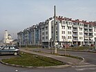
Istočno Sarajevo
|
City of East Sarajevo Grad Istočno Sarajevo Град Источно Сарајево |
|||||
|---|---|---|---|---|---|
| City | |||||
|
|||||
|
|||||
 Location of Istočno Sarajevo within Bosnia and Herzegovina |
|||||
| Coordinates: 43°49′N 18°21′E / 43.817°N 18.350°ECoordinates: 43°49′N 18°21′E / 43.817°N 18.350°E | |||||
| Country | Bosnia and Herzegovina | ||||
| Entity | Republika Srpska | ||||
| Area | |||||
| • Total | 1,450 km2 (560 sq mi) | ||||
| Population (2013) | |||||
| • Total | 61,516 | ||||
| Time zone | CET (UTC+1) | ||||
| • Summer (DST) | CEST (UTC+2) | ||||
| Area code(s) | (387) 57 | ||||
| Website | |||||
Istočno Sarajevo (Serbian Cyrillic: Источно Сарајево; trans. East Sarajevo) is the eastern part of Sarajevo city. East Sarajevo consists of a few pre-war suburban parts of Sarajevo which are now in the Republika Srpska entity, and newly built areas. It was previously known as Srpsko Sarajevo (Serbian Cyrillic: Српско Сарајево; trans. Serb Sarajevo) but the Constitutional Court of Bosnia and Herzegovina adjudicated its name change.
At about 1450 km2, it is one of the biggest cities in the Balkans in terms of area, because it consists of some towns and villages of the pre-war Sarajevan suburbs in that area. As of the 2013 census, East Sarajevo has 61,516 inhabitants. It is a part of the Sarajevo Metropolitan Area.
The first civilian government in the territory of East Sarajevo was formed at the parliamentary session in the building of the local community Lukavica late summer of 1992. year. The commission organized by the Serbian municipality of Novo Sarajevo, headed by a Commissioner of the Presidency of the Republic of Srpska dr Dragan Đokanović, was held the Municipal Assembly of Srpsko Novo Sarajevo, consisting of the members of Serbian nationality, pre-war Sarajevo municipality of Novo Sarajevo. Invited members, elected in multiparty elections 1990th, elected municipal government.
East Sarajevo lies in the Sarajevo valley, in the middle of the Dinaric Alps. The city is surrounded by heavily forested hills and five major mountains. The highest of the surrounding peaks is Treskavica at 2,088 meters (6,850 ft), then Bjelašnica at 2,067 meters (6,781 ft), Jahorina at 1,913 meters (6,276 ft), Trebević at 1,627 meters (5,338 ft), with 1,502 meters (4,928 ft) Igman being the shortest. Last four are also known as Olympics mountains of Sarajevo (see also 1984 Winter Olympics Games in Sarajevo).
...
Wikipedia


