Ithaca, Nebraska
| Ithaca, Nebraska | |
|---|---|
| Village | |

Historic grain elevator in Ithaca. Built ca. 1890, it is listed in the National Register of Historic Places.
|
|
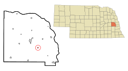
 Location of Ithaca, Nebraska |
|
| Coordinates: 41°9′37″N 96°32′23″W / 41.16028°N 96.53972°WCoordinates: 41°9′37″N 96°32′23″W / 41.16028°N 96.53972°W | |
| Country | United States |
| State | Nebraska |
| County | Saunders |
| Area | |
| • Total | 0.23 sq mi (0.60 km2) |
| • Land | 0.23 sq mi (0.60 km2) |
| • Water | 0 sq mi (0 km2) |
| Elevation | 1,175 ft (358 m) |
| Population (2010) | |
| • Total | 148 |
| • Estimate (2012) | 147 |
| • Density | 643.5/sq mi (248.5/km2) |
| Time zone | Central (CST) (UTC-6) |
| • Summer (DST) | CDT (UTC-5) |
| ZIP code | 68033 |
| Area code(s) | 402 |
| FIPS code | 31-24285 |
| GNIS feature ID | 0830312 |
Ithaca is a village in Saunders County, Nebraska, United States. The population was 148 at the 2010 census. Even though a small village, Ithaca has attracted several notable residents to the surrounding area. Being close to both Omaha and Lincoln has made it an excellent location for more wealthy urbanites to build homes in the country.
Ithaca was founded in 1866. It was named after Ithaca, New York, the native home of a pioneer settler.
Ithaca is located at 41°9′37″N 96°32′23″W / 41.16028°N 96.53972°W (41.160392, -96.539861).
According to the United States Census Bureau, the village has a total area of 0.23 square miles (0.60 km2), all land.
As of the census of 2010, there were 148 people, 57 households, and 40 families residing in the village. The population density was 643.5 inhabitants per square mile (248.5/km2). There were 58 housing units at an average density of 252.2 per square mile (97.4/km2). The racial makeup of the village was 93.9% White, 4.1% Native American, and 2.0% from other races. Hispanic or Latino of any race were 8.1% of the population.
...
Wikipedia
