Kabuntalan, Maguindanao
| Kabuntalan | |
|---|---|
| Municipality | |
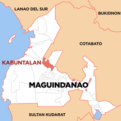
 Map of Maguindanao showing the location of Kabuntalan |
|
| Location within the Philippines | |
| Coordinates: 7°7′0″N 124°23′0″E / 7.11667°N 124.38333°ECoordinates: 7°7′0″N 124°23′0″E / 7.11667°N 124.38333°E | |
| Country |
|
| Region | Autonomous Region in Muslim Mindanao (ARMM) |
| Province | Maguindanao |
| Barangays | 17 |
| Government | |
| • Mayor | Bai Lannie D. Diocolano |
| Area | |
| • Total | 371.08 km2 (143.27 sq mi) |
| Population (2015 census) | |
| • Total | 17,276 |
| • Density | 47/km2 (120/sq mi) |
| Time zone | PST (UTC+8) |
| ZIP code | 9606 |
| IDD : area code | +63 (0)64 |
| Income class | 5th municipal income class |
| 153814000 | |
| Electorate | 9,675 voters as of 2016 |
| Website | www |
Kabuntalan (formerly Tumbao) is a 6th class municipality of Maguindanao, Philippines. According to the 2015 census, it has a population of 17,276 people.
The town was part of the province of Shariff Kabunsuan from October 2006 until its nullification by the Supreme Court in July 2008.
Kabuntalan is politically subdivided into 17 barangays.
...
Wikipedia

