Kamensky District, Altai Krai
| Kamensky District Каменский район (Russian) |
|
|---|---|
 Location of Kamensky District in Altai Krai |
|
| Coordinates: 53°48′N 81°21′E / 53.800°N 81.350°ECoordinates: 53°48′N 81°21′E / 53.800°N 81.350°E | |
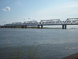
 Bridge over the Ob River in Kamen-na-Obi, the administrative center of the district |
|
| Location | |
| Country | Russia |
| Federal subject | Altai Krai |
| Administrative structure (as of September 2015) | |
| Administrative center | town of Kamen-na-Obi |
| Administrative divisions: | |
| Towns of district significance | 1 |
| Selsoviets | 13 |
| Inhabited localities: | |
| Rural localities | 33 |
| Municipal structure (as of September 2015) | |
| Municipally incorporated as | Kamensky Municipal District |
| Municipal divisions: | |
| Urban settlements | 1 |
| Rural settlements | 13 |
| Statistics | |
| Area | 3,666 km2 (1,415 sq mi) |
| Population (2010 Census) | 12,025 inhabitants |
| • Urban | 0% |
| • Rural | 100% |
| Density | 3.28/km2 (8.5/sq mi) |
| Time zone | KRAT (UTC+07:00) |
| Official website | |
| on | |
| 2010 Census | 12,025 |
|---|---|
| 2002 Census | 16,600 |
| 1989 Census | 16,977 |
| 1979 Census | 18,801 |
Kamensky District (Russian: Ка́менский райо́н) is an administrative and municipal district (raion), one of the fifty-nine in Altai Krai, Russia. It is located in the north of the krai and borders Krutikhinsky and Suzunsky Districts of Novosibirsk Oblast in the north, Shelabolikhinsky District in the east, Bayevsky and Tyumentsevsky Districts in the south, and Pankrushikhinsky District in the west. The area of the district is 3,666 square kilometers (1,415 sq mi). Its administrative center is town of Kamen-na-Obi. As of the 2010 Census, the total population of the district was 12,025.
The district is located on the northern border of Altai Krai, straddling the Ob River, which runs through the district from east to west as it makes its turn to the north. The terrain is hilly steppe on the Priobsky Plateau. Besides the Ob, the district is also watered by the , which has its head pumping station in Kamen-no-Obi. While much of the area is agricultural land, there are forests in the east on the meandering Ob floodplain, as well as numerous fresh and saltwater lakes. The soils are medium chernozem (black),sandy soils. The regional city of Barnaul is 125 km to the east.
Average temperature in January is −19.7 °C (−3.5 °F), and average July temperature is 18.9 °C (66.0 °F). Annual precipitation is 330 millimeters (13 in). The climate is Humid continental climate, cool summer, (Dfb). This climate is characterized by large swings in temperature, both diurnially and seasonally, with mild summers and cold, snowy winters.
...
Wikipedia
