Kareli, Madhya Pradesh
|
Kareli करेली |
|
|---|---|
| City | |
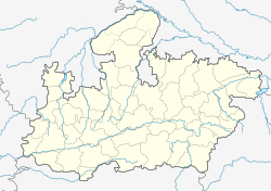
| Location in Madhya Pradesh, India | |
| Coordinates: 22°56′01″N 79°03′44″E / 22.9336171°N 79.0622162°ECoordinates: 22°56′01″N 79°03′44″E / 22.9336171°N 79.0622162°E | |
| Country |
|
| State | Madhya Pradesh |
| District | Narsinghpur |
| Government | |
| • Type | Local government |
| • Body | Municipality |
| Elevation | 348 m (1,142 ft) |
| Population (2011) | |
| • Total | 45,000 |
| Demonym(s) | 920 |
| Languages | |
| • Official | Hindi |
| Time zone | IST (UTC+5:30) |
| PIN | 487221 |
| Telephone code | 07793 |
| Vehicle registration | MP-49 |
Kareli is a town and a Nagar Palika in Narsinghpur District in the Indian state of Madhya Pradesh. Before the construction of the Bina-Katni branch of the Indian Midland Railway, the metaled road from Saugor crossing the Nerbudda at Barmhan brought the bulk of the produce of the Sagar District to Kareli station. A mail cart ran from Kareli to Sagar, a distance of 122 km (76 mi). The trade of Kareli has now considerably declined, but it is still the exporting station for the southern parts of the Rehli tahsil of Sagar and the north of Narsinghpur. A cotton-ginning factory, the property of Raja Gokul Das, was opened in 1904.This still is a nearest rail station and market for important towns of Sagar Districts.
Kareli was formerly a municipality but its municipal constitution was abolished in 1897, and the provisions of the Village Sanitation Act were introduced.
There are 15 wards in Kareli municipality and the Nagar Palika Adhyaksha (Mayor) is the chief of the municipality.
There are Sub-Divisional Magistrate and Tehsildar office.
Kareli Police Station/ Thana with the office of the Deputy Superintendent of Police (DSP). In addition, nearest Railway police Chowky of Railway Protection Force is at Kareli.
There is an office of the Civil Judge.
Kareli is located at 22°56′01″N 79°03′44″E / 22.9336171°N 79.0622162°E. It has an average elevation of 348 metres (1,142 ft).
...
Wikipedia


