Karimunjawa National Park
| Karimunjawa National Park | |
|---|---|
| Taman Nasional Karimunjawa | |
|
IUCN category II (national park)
|
|

Tanjung Gelam, one of the beaches in Karimunjawa
|
|
|
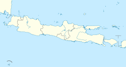
Location in Java
|
|
| Location | Karimunjava Islands, Jepara Regency, Central Java, Indonesia |
| Nearest city | Jepara |
| Coordinates | 5°49′S 110°24′E / 5.817°S 110.400°ECoordinates: 5°49′S 110°24′E / 5.817°S 110.400°E |
| Area | 110,117 hectares (272,110 acres; 1,101.17 km2) (including land) |
| Established | 2001 |
| Visitors | 1,951 (in 2007) |
| Governing body | Ministry of Environment and Forestry |
Crimon Java National Park, also Karimunjava National Park, is a national marine park designated in the Karimun Java archipelago, Jepara Regency, Central Java, Indonesia. It lies 80 km north west of Jepara, Central Java in the Java Sea. The national park was formally declared as Marine Protection Area in 2001. Based on popular local myth, this archipelago was discovered by Sunan Nyamplungan, the nephew of Sunan Kudus who is one of the Wali Sanga.
Karimun Java is also a tourist attraction popular for its white sandy beach, pristine coral reefs, challenging treks through the hills, the pilgrimage to Sunan Nyamplungan Cemetery, and the customs and traditions of the Karimunjava community.
The Crimon Java archipelago lies from 5°49’ - 5°57’ South Latitude and 110°04' - 110°40' East Longitude in the Java Sea, north of Java. It is about 120 km from Semarang, the capital of Central Java Province; and about 80 km from the nearest town Jepara. Comprising 27 islands, the Karimunjawa subdistrict is divided into three villages, namely Karimunjawa, Kemujan and Parang. The archipelago is under the administration of Jepara Regency, Central Java Province.
The geological formation in the archipelago is mostly dominated by quartz sand stone, gravel, mud, and clay. The topography of Karimunjawa Marine National Park is a wave of low land, with elevation ranging from 0–506 meters above sea level. Gajah hill is the Park’s highest point. Temperatures range from 30-31 °C.
The biggest island in the archipelago is Karimunjawa Island. Towns or villages are located in Karimunjava, Kemujan, Nyamuk, Parang, and Genting Island. The other islands are uninhabited.
Many researchers have been attracted to the marine biodiversity and pristine forest as well as the uniqueness of the Karimunjawa archipelago. During the Dutch colonial era, many Dutch botanists such as Teijsmann (1854), Koorders (1886), Schlechter (1910) and Dammerman (1926) came to the Karimunjawa archipelago.
...
Wikipedia

