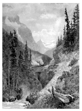
Kicking Horse Pass
| Kicking Horse Pass | |
|---|---|

1887 painting
|
|
| Elevation | 1,627 m (5,338 ft) |
| Traversed by | Trans-Canada Highway; Canadian Pacific Railway |
| Location | Banff National Park, Alberta / Yoho National Park, British Columbia, Canada |
| Range | Canadian Rockies |
| Coordinates | 51°27′10″N 116°17′00″W / 51.45278°N 116.28333°WCoordinates: 51°27′10″N 116°17′00″W / 51.45278°N 116.28333°W |
| Official name | Kicking Horse Pass National Historic Site of Canada |
| Designated | 1971 |
Kicking Horse Pass (el. 1627 m, 5339 ft) is a high mountain pass across the Continental Divide of the Americas of the Canadian Rockies on the Alberta/British Columbia border, and lying within Yoho and Banff National Parks. A National Historic Site of Canada, the pass is of historical significance because the main line of the Canadian Pacific Railway (CPR) was constructed between Lake Louise, Alberta and Field, British Columbia using this route in 1880s, in preference to the originally planned route through the more northerly Yellowhead Pass.
The pass was first explored by Europeans in 1858 by the Palliser Expedition led by Captain John Palliser. The pass and the adjacent Kicking Horse River were given their names after James Hector, a naturalist, geologist, and surgeon who was a member of the expedition, was kicked by his horse while exploring the region.
The original route of the CPR between the summit of the pass near Wapta Lake and Field was known as "The Big Hill"; with a ruling gradient of 4.5 percent (1 in 23), it was the steepest stretch of main-line railroad in North America.
...
Wikipedia
