Koloa
| Koloa, Hawaii | |
|---|---|
| Census-designated place | |

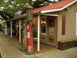
A shop in Kōloa
|
|
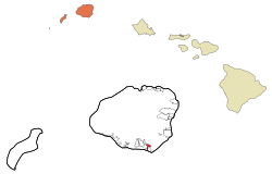
 Location in Kauai County and the state of Hawaii |
|
| Coordinates: 21°54′26″N 159°27′57″W / 21.90722°N 159.46583°WCoordinates: 21°54′26″N 159°27′57″W / 21.90722°N 159.46583°W | |
| Country | United States |
| State | Hawaii |
| County | Kauai |
| Area | |
| • Total | 1.2 sq mi (3.1 km2) |
| • Land | 1.2 sq mi (3.1 km2) |
| • Water | 0.0 sq mi (0.0 km2) |
| Elevation | 213 ft (65 m) |
| Population (2010) | |
| • Total | 2,144 |
| • Density | 1,786.6/sq mi (691.6/km2) |
| Time zone | Hawaii-Aleutian (UTC-10) |
| ZIP code | 96756 |
| Area code(s) | 808 |
| FIPS code | 15-39200 |
| GNIS feature ID | 0361395 |
Kōloa is a census-designated place (CDP) in Kauaʻi County, Hawaiʻi, United States. The population was 1,942 at the 2000 census. Kōloa is often incorrectly translated as native duck, which is the correct translation for the similar-looking koloa (without the macron).Kōloa has no known translation. According to one account, the district Kōloa was named for a steep rock called Pali-o-kō-loa which was found in 'Waikomo' stream. The first successful sugarcane plantation in the Islands was started here in 1835. It became a part of Grove Farm in 1948.
Kōloa is located at 21°54′26″N 159°27′57″W / 21.90722°N 159.46583°W (21.907137, -159.465877).
According to the United States Census Bureau, the CDP has a total area of 1.2 square miles (3.1 km2), all of it land.
As of the census of 2000, there were 1,942 people, 693 households, and 507 families residing in the CDP. The population density was 1,629.5 people per square mile (630.1/km2). There were 748 housing units at an average density of 627.6 per square mile (242.7/km2). The racial makeup of the CDP was 20.2% White, 0.4% African American, 0.3% Native American, 43.8% Asian, 7.8% Pacific Islander, 1.2% from other races, and 26.4% from two or more races. Hispanic or Latino of any race were 11.4% of the population.
...
Wikipedia
