Kuressaare
| Kuressaare | |||
|---|---|---|---|

|
|||
|
|||
| Location of Kuressaare in Estonia | |||
| Coordinates: 58°15′N 22°29′E / 58.250°N 22.483°ECoordinates: 58°15′N 22°29′E / 58.250°N 22.483°E | |||
| Country |
|
||
| County |
|
||
| First appeared on map | 1154 | ||
| Government | |||
| • Mayor | Madis Kallas | ||
| Area | |||
| • Total | 14.95 km2 (5.77 sq mi) | ||
| Elevation | 5 m (16 ft) | ||
| Population (2012) | |||
| • Total | 13,166 | ||
| • Density | 880/km2 (2,300/sq mi) | ||
| Ethnicity | |||
| • Estonians | 97.6% | ||
| • Russians | 1.2% | ||
| • Finns | 0.3% | ||
| • other | 2,4% | ||
| Time zone | EET (UTC+2) | ||
| • Summer (DST) | EEST (UTC+3) | ||
| Postal code | 93813 | ||
| Area code(s) | (+372) 045 | ||
| Vehicle registration | K | ||
| Website | www.kuressaare.ee | ||
Kuressaare (Estonian pronunciation: [ˈkuresˑ'sɑːre]), also known as Arensburg, is a town and a municipality on Saaremaa island in Estonia. It is the capital of Saare County and the westernmost town in Estonia. The population, according to the 2011 census, was 13,166.
The town is situated on the coast of the Gulf of Riga and is served by the Kuressaare Airport, Roomassaare Harbor, and Kuressaare Yacht Harbor.
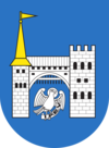
Its historic name Arensburg (from Middle High German a(a)r: eagle, raptor) renders the Latin denotation arx aquilae for the city's castle. The fortress and the eagle, tetramorph symbol of Saint John the Evangelist, are also the depicted on Kuressaare's coat of arms.
The town, which grew around the fortress, was simultaneously known as Arensburg and Kuressaarelinn; the latter name being a combination of Kuressaare—an ancient name of the Saaremaa Island—and linn, which means town. Eventually, the town's name shortened to Kuressaare and became official in 1918 after Estonia had declared its independence from Bolshevist Russia. Under the Soviet rule, the town was renamed Kingissepa in 1952; after the Bolshevik Kuressaare-native Viktor Kingissepp executed in 1922. The name Kuressaare was restored in 1990. It is called in Finnish: Kuressaari and in German: Arensburg.
...
Wikipedia


