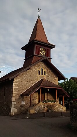
La Chaux (Cossonay)
| La Chaux | ||
|---|---|---|
 |
||
|
||
| Coordinates: 46°37′N 06°28′E / 46.617°N 6.467°ECoordinates: 46°37′N 06°28′E / 46.617°N 6.467°E | ||
| Country | Switzerland | |
| Canton | Vaud | |
| District | Morges | |
| Government | ||
| • Mayor | Syndic | |
| Area | ||
| • Total | 6.75 km2 (2.61 sq mi) | |
| Elevation | 557 m (1,827 ft) | |
| Population (Dec 2015) | ||
| • Total | 421 | |
| • Density | 62/km2 (160/sq mi) | |
| Postal code | 1308 | |
| SFOS number | 5474 | |
| Surrounded by | Chavannes-le-Veyron, Chevilly, Cossonay, Cuarnens, Dizy, Grancy, Moiry, Senarclens | |
| Website |
www Profile (French), SFSO statistics |
|
La Chaux is a municipality of the canton of Vaud in Switzerland, located in the district of Morges.
La Chaux is first mentioned in 1228 as La Chaus. In 1277 it was mentioned as de Calce. It was known as La Chaux (VD) until 1953.
In the 13th century the village belonged to the Knights Templar and it came into the possession of the Order of St John in 1315. It was united with the settlement at Cransaz to form a commandry which was headed by the preceptors of Vaud. The Preceptors were, until 1580, the patrons of Montbrelloz, Fribourg, and Saint-Jean de Grosset, Pays de Gex. The commandery was abolished during the Protestant Reformation.
La Chaux has an area, as of 2009[update], of 6.75 square kilometers (2.61 sq mi). Of this area, 5.17 km2 (2.00 sq mi) or 76.6% is used for agricultural purposes, while 1.16 km2 (0.45 sq mi) or 17.2% is forested. Of the rest of the land, 0.42 km2 (0.16 sq mi) or 6.2% is settled (buildings or roads), 0.03 km2 (7.4 acres) or 0.4% is either rivers or lakes and 0.01 km2 (2.5 acres) or 0.1% is unproductive land.
Of the built up area, housing and buildings made up 2.5% and transportation infrastructure made up 1.6%. Power and water infrastructure as well as other special developed areas made up 1.6% of the area Out of the forested land, 15.6% of the total land area is heavily forested and 1.6% is covered with orchards or small clusters of trees. Of the agricultural land, 61.9% is used for growing crops and 13.6% is pastures. All the water in the municipality is flowing water.
The municipality was part of the Cossonay District until it was dissolved on 31 August 2006, and La Chaux became part of the new district of Morges.
The village of La Chaux is located on the left bank of the Veyron river with the village of Ittens on the right bank of the river.
...
Wikipedia


