Lakeside, Oregon
| Lakeside, Oregon | |
|---|---|
| City | |

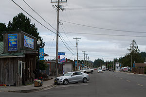
Looking north on South Eighth Street
|
|
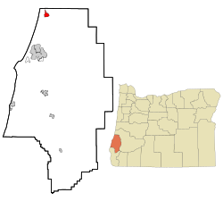
 Location in Oregon |
|
| Coordinates: 43°34′44″N 124°10′28″W / 43.57889°N 124.17444°WCoordinates: 43°34′44″N 124°10′28″W / 43.57889°N 124.17444°W | |
| Country | United States |
| State | Oregon |
| County | Coos |
| Incorporated | 1974 |
| Government | |
| • Mayor | L. Dean Warner |
| Area | |
| • Total | 2.29 sq mi (5.93 km2) |
| • Land | 2.00 sq mi (5.18 km2) |
| • Water | 0.29 sq mi (0.75 km2) |
| Elevation | 23 ft (7 m) |
| Population (2010) | |
| • Total | 1,699 |
| • Estimate (2012) | 1,690 |
| • Density | 849.5/sq mi (328.0/km2) |
| Time zone | Pacific (UTC-8) |
| • Summer (DST) | Pacific (UTC-7) |
| ZIP code | 97449 |
| Area code(s) | 541 |
| FIPS code | 41-40650 |
| GNIS feature ID | 1144789 |
Lakeside is a city in Coos County, Oregon, United States. The population was 1,699 at the 2010 census.
Lakeside is in Coos County, Oregon, along U.S. Route 101, about 1 mile (2 km) inland from the Pacific Ocean. The city is 15 miles (24 km) north of Coos Bay and 197 miles (317 km) southwest of Portland.
Lakeside borders Tenmile Lake and Tenmile Creek, which flows from the lake to the ocean. The city is 23 feet (7.0 m) above sea level. According to the United States Census Bureau, the city has a total area of 2.29 square miles (5.93 km2), of which 2.00 square miles (5.18 km2) is land and 0.29 square miles (0.75 km2) is water.
As of the census of 2010, there were 1,699 people, 806 households, and 489 families residing in the city. The population density was 849.5 inhabitants per square mile (328.0/km2). There were 967 housing units at an average density of 483.5 per square mile (186.7/km2). The racial makeup of the city was 94.4% White, 0.3% African American, 1.5% Native American, 0.2% Asian, 0.9% from other races, and 2.6% from two or more races. Hispanic or Latino of any race were 3.2% of the population.
...
Wikipedia
