Lazarevo, Jewish Autonomous Oblast
| Lazarevo (English) Лазарево (Russian) |
|
|---|---|
| - Town - | |
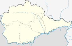
 Location of the Jewish Autonomous Oblast in Russia |
|
|
|
|
|
|
|
| Administrative status (as of July 2011) | |
| Country | Russia |
| Federal subject | Jewish Autonomous Oblast |
| Administrative district | Leninsky District |
| Administrative center of | Lazarevskoye Rural Settlement |
| Statistics | |
| Population (2010 Census) | 751 inhabitants |
| Time zone | VLAT (UTC+10:00) |
Lazarevo (Russian: Лазарево) is a small town in Leninsky District in the Jewish Autonomous Oblast, Russia. It is the head of Lazarevskoye Rural Settlement.
Lazarevo is located at an elevation of 140 meters (460 ft) by a small mountain range north of the Amur River. The town lies 86 kilometers (53 mi) southwest of Birobidzhan, the administrative center of the autonomous oblast. Its population is 751 (2010 Census);
Lazarevo is the birthplace of Soviet Arctic explorer Georgy Ushakov (1901 - 1963) who fully surveyed and charted Severnaya Zemlya for the first time in history.
...
Wikipedia

