Le Haut-Richelieu Regional County Municipality
| Le Haut-Richelieu | |
|---|---|
| Regional county municipality | |
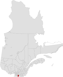
 Location in province of Quebec. |
|
| Coordinates: 45°12′N 73°14′W / 45.200°N 73.233°WCoordinates: 45°12′N 73°14′W / 45.200°N 73.233°W | |
| Country |
|
| Province |
|
| Region | Montérégie |
| Effective | January 1, 1982 |
| County seat | Saint-Jean-sur-Richelieu |
| Government | |
| • Type | Prefecture |
| • Prefect | Gilles Dolbec |
| Area | |
| • Total | 999.70 km2 (385.99 sq mi) |
| • Land | 936.26 km2 (361.49 sq mi) |
| Population (2011) | |
| • Total | 114,344 |
| • Density | 122.1/km2 (316/sq mi) |
| • Pop 2006-2011 |
|
| • Dwellings | 50,665 |
| Time zone | EST (UTC−5) |
| • Summer (DST) | EDT (UTC−4) |
| Area code(s) | 450 and 579 |
| Website | www |
Le Haut-Richelieu (Upper Richelieu) is a regional county municipality in the Montérégie region in southwestern Quebec, Canada. Its seat is in Saint-Jean-sur-Richelieu. It is named for the Richelieu River which runs south-north through it.
There are 14 subdivisions within the RCM:
Highways and numbered routes that run through the municipality, including external routes that start or finish at the county border:
...
Wikipedia
