Ligonier, Indiana
| Ligonier, Indiana | |
|---|---|
| City | |
| City of Ligonier | |

Downtown Ligonier.
|
|
| Motto: "City Of Murals" | |
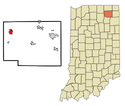
 Location in the state of Indiana |
|
| Coordinates: 41°27′51″N 85°35′29″W / 41.46417°N 85.59139°WCoordinates: 41°27′51″N 85°35′29″W / 41.46417°N 85.59139°W | |
| Country | United States |
| State | Indiana |
| County | Noble |
| Township | Perry |
| Government | |
| • Mayor | Patricia A. Fisel (R) |
| Area | |
| • Total | 2.31 sq mi (5.98 km2) |
| • Land | 2.31 sq mi (5.98 km2) |
| • Water | 0 sq mi (0 km2) 0% |
| Elevation | 869 ft (265 m) |
| Population (2010) | |
| • Total | 4,405 |
| • Estimate (2012) | 4,388 |
| • Density | 1,906.9/sq mi (736.3/km2) |
| Time zone | EST (UTC-5) |
| • Summer (DST) | EDT (UTC-4) |
| ZIP code | 46767 |
| Area code(s) | 260 |
| FIPS code | 18-43686 |
| GNIS feature ID | 0437883 |
| Website | http://ligonier-in.org/ |
Ligonier is a city in Perry Township, Noble County, Indiana, United States. The population was 4,405 at the 2010 census.
Ligonier was platted in 1835. The city was named for John Ligonier, a British army officer.
The Ligonier Historical Museum is located in the 1889 building of the Ahavas Sholem Synagogue, one of the few surviving 19th-century synagogues in the United States.
The Ahavas Shalom Reform Temple, Ligonier Historic District, and Jacob Straus House are listed on the National Register of Historic Places.
Ligonier is located at 41°27′51″N 85°35′29″W / 41.46417°N 85.59139°W (41.464247, -85.591258).
According to the 2010 census, Ligonier has a total area of 2.31 square miles (5.98 km2), all land.
As of the census of 2010, there were 4,405 people, 1,333 households, and 978 families residing in the city. The population density was 1,906.9 inhabitants per square mile (736.3/km2). There were 1,550 housing units at an average density of 671.0 per square mile (259.1/km2). The racial makeup of the city was 69.6% White, 0.4% African American, 0.2% Native American, 0.5% Asian, 26.6% from other races, and 2.7% from two or more races. Hispanic or Latino of any race were 51.5% of the population.
...
Wikipedia
