List of storms in the 2005 Atlantic hurricane season
| Tropical storm (SSHWS) |
|
|
| Duration |
June 8 – June 13 |
| Peak intensity |
70 mph (110 km/h) (1-min) 989 mbar (hPa) |
| Tropical storm (SSHWS) |
|
|
| Duration |
June 28 – June 30 |
| Peak intensity |
40 mph (65 km/h) (1-min) 1002 mbar (hPa) |
| Category 1 hurricane (SSHWS) |
|
|
| Duration |
July 3 – July 7 |
| Peak intensity |
75 mph (120 km/h) (1-min) 991 mbar (hPa) |
| Category 4 hurricane (SSHWS) |
|
|
| Duration |
July 4 – July 13 |
| Peak intensity |
150 mph (240 km/h) (1-min) 930 mbar (hPa) |
| Category 5 hurricane (SSHWS) |
|
|
| Duration |
July 11 – July 21 |
| Peak intensity |
160 mph (260 km/h) (1-min) 929 mbar (hPa) |
| Tropical storm (SSHWS) |
|
|
| Duration |
July 21 – July 29 |
| Peak intensity |
70 mph (110 km/h) (1-min) 997 mbar (hPa) |
| Tropical storm (SSHWS) |
|
|
| Duration |
July 23 – July 25 |
| Peak intensity |
45 mph (75 km/h) (1-min) 1005 mbar (hPa) |
| Tropical storm (SSHWS) |
|
|
| Duration |
August 2 – August 8 |
| Peak intensity |
65 mph (100 km/h) (1-min) 994 mbar (hPa) |
| Category 2 hurricane (SSHWS) |
|
|
| Duration |
August 4 – August 18 |
| Peak intensity |
105 mph (165 km/h) (1-min) 970 mbar (hPa) |
| Tropical depression (SSHWS) |
|
|
| Duration |
August 13 – August 14 |
| Peak intensity |
35 mph (55 km/h) (1-min) 1008 mbar (hPa) |
The 2005 Atlantic hurricane season officially began June 1, 2005 and officially ended on November 30, 2005. These dates conventionally delimit the period of each year when most tropical cyclones form in the Atlantic basin, although effectively the season persisted into January 2006 due to continued storm activity.
The 2005 season was the most active season on record, shattering records on repeated occasions. A record 28 tropical and subtropical storms formed, of which a record fifteen became hurricanes. Of these, seven strengthened into major hurricanes, a record-tying five became category 4 hurricanes, a record four of which reached Category 5 strength, the highest categorization for North Atlantic tropical cyclones. Among these Category 5 storms was Hurricane Wilma, the most intense hurricane ever recorded in the Atlantic.
The most notable storms of the season were the five Category 4 and Category 5 hurricanes: Dennis, Emily, Katrina, Rita, and Wilma, along with the Category 1 Hurricane Stan. These storms made a combined twelve landfalls as major hurricanes (Category 3 strength or higher) throughout Cuba, Mexico, and the Gulf Coast of the United States, causing over $100 billion (2005 USD) in damages and at least 2,048 deaths.
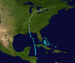
Early in the season, a low-pressure area formed and persisted north of Honduras. Despite moderate wind shear, the low managed to organize, and was designated Tropical Depression One on June 8. The storm strengthened further, and it was upgraded to Tropical Storm Arlene on the following day. From this point, Arlene headed north, intensifying steadily as it spread tropical storm-force winds and heavy rains to the Cayman Islands and Cuba. Arlene made landfall in Cuba near Cabo Corrientes with 50 mph (80 km/h) winds. Wind shear weakened as the storm entered the Gulf of Mexico on the morning of June 10, and the storm intensified to just under hurricane strength with 70 mph (110 km/h) winds.
...
Wikipedia


