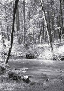
Little Applegate River
| Little Applegate River | |
|
The Little Applegate River
|
|
| Name origin: Named after the Applegate River, which in turn was named after Lindsay Applegate | |
| Country | United States |
|---|---|
| State | Oregon |
| County | Jackson |
| Source | Near Siskiyou Peak |
| - location | Siskiyou Mountains, Jackson County, Oregon |
| - elevation | 5,735 ft (1,748.0 m) |
| - coordinates | 42°03′06″N 122°48′15″W / 42.05167°N 122.80417°W |
| Mouth | Applegate River |
| - location | about 3 miles (4.8 km) northwest of Buncom, Jackson County, Oregon |
| - elevation | 1,440 ft (438.9 m) |
| - coordinates | 42°11′55″N 123°02′43″W / 42.19861°N 123.04528°WCoordinates: 42°11′55″N 123°02′43″W / 42.19861°N 123.04528°W |
| Length | 21 mi (34 km) |
| Basin | 113 sq mi (293 km2) |
| Discharge | mouth |
| - average | 226 cu ft/s (6.40 m3/s) |
|
The Little Applegate River watershed
|
|
The Little Applegate River is a 21-mile-long (34 km) tributary of the Applegate River located in the U.S. state of Oregon. It is part of the Rogue River watershed, draining approximately 113 square miles (293 km2) of Jackson County. Rising in the Siskiyou Mountains, the river flows generally northwest to meet the Applegate about 3 miles (4.8 km) northwest of Buncom and 2 miles (3.2 km) south of Ruch.
The Little Applegate River's watershed was originally settled about 11,000 years ago by the Latgawa, Shasta, and Dakubetede Native American tribes. The first non-indigenous settlers arrived in the early 19th century. Two boomtowns—Sterlingville and Buncom—were founded in the 1850s and grew rapidly as gold and other precious metals were discovered. They slowly declined in population as the supply of gold was exhausted; only three buildings remain in Buncom, while Sterlingville was abandoned and later destroyed.
Despite low water quality, the Little Applegate watershed supports populations of coho and Chinook salmon, along with 138 known and 134 suspected species of other vertebrates. Sixty-four percent of the watershed is forested, although its health is slowly declining due to fire suppression.
The Little Applegate River arises at several springs near Siskiyou Peak, in the Siskiyou Mountains. It flows north, receiving McDonald Creek on the , and Glade Creek on the . Water is diverted into Sterling Ditch near the Little Applegate's confluence with Glade Creek. Sterling Ditch is an approximately 23-mile-long (37 km) aqueduct, built in 1877 to provide water for hydraulic mining in the now destroyed town of Sterlingville.
...
Wikipedia


