Luisin
| Luisin | |
|---|---|

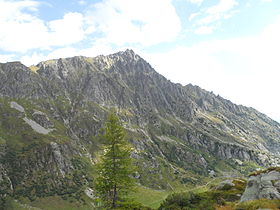
The south face seen from the Emaney valley
|
|
| Highest point | |
| Elevation | 2,786 m (9,140 ft) |
| Prominence | 324 m (1,063 ft) |
| Parent peak | Dents du Midi |
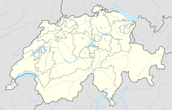
| Coordinates | 46°07′15″N 6°58′12″E / 46.12083°N 6.97000°ECoordinates: 46°07′15″N 6°58′12″E / 46.12083°N 6.97000°E |
| Geography | |
| Location | Valais, Switzerland |
| Parent range | Chablais Alps |
| Climbing | |
| Easiest route | Hiking |
The Luisin is a mountain of the Chablais Alps, overlooking Les Marécottes in the canton of Valais. It lies east of the Tour Sallière, on the range between the lake of Salanfe and the valley of Trient.
...
Wikipedia

