M'Sila, Algeria
|
M'sila الجزائر |
|
|---|---|
| city | |

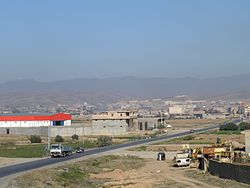
Overview of M'silla
|
|
 |
|
| Coordinates: 35°42′7″N 4°32′49″E / 35.70194°N 4.54694°E | |
| Country |
|
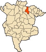
| Province | M'Sila Province |
| District | M'Sila District |
| Elevation | 471 m (1,545 ft) |
| Population (2008 census) | |
| • Total | 132,975 |
| Time zone | CET (UTC+1) |
M'Sila (also spelled Msila or MSila) (Arabic: الجزائر); is the capital of M'Sila Province, Algeria, and is co-extensive with M'Sila District. It has a population of over 100,000. M'Sila University is also located in this city.
M'Sila was the location of the first village constructed as part of a government-run program to transition nomadic Algerians to sedentary life using local materials. The village, now complete, was dubbed Maader and consists of houses, public and trading areas, and a mosque. Today it is much more developed with many companies, business offices, religious centers and schools.
M'Sila is primarily known for its farming and small business.
Coordinates: 35°42′07″N 4°32′50″E / 35.70194°N 4.54722°E
...
Wikipedia

