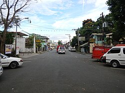
Mataasnakahoy, Batangas
| Mataasnakahoy | ||
|---|---|---|
| Municipality | ||
 |
||
|
||
 Location within Batangas Province |
||
| Location within the Philippines | ||
| Coordinates: 13°58′N 121°05′E / 13.97°N 121.08°ECoordinates: 13°58′N 121°05′E / 13.97°N 121.08°E | ||
| Country | Philippines | |
| Region | Calabarzon (Region IV-A) | |
| Province | Batangas | |
| District | 3rd District | |
| Founded | March 27, 1931 | |
| Barangays | 16 (see Barangays) | |
| Government | ||
| • Type | Sangguniang Bayan | |
| • Mayor | Gualberto Recinto Silva | |
| Area | ||
| • Total | 22.10 km2 (8.53 sq mi) | |
| Population (2015 census) | ||
| • Total | 29,187 | |
| • Density | 1,300/km2 (3,400/sq mi) | |
| • Voter (2016) | 17,590 | |
| Time zone | PST (UTC+8) | |
| ZIP code | 4223 | |
| IDD : area code | +63 (0)43 | |
| Income class | 4th class | |
| PSGC | 041018000 | |
| Website | mataasnakahoy |
|
Mataasnakahoy, officially the Municipality of Mataasnakahoy (Filipino: Bayan ng Mataasnakahoy), is a municipality in the province of Batangas in the Calabarzon (Region IV-A) of the Philippines. The population was 29,187 at the 2015 census. In the 2016 electoral roll, it had 17,590 registered voters.
Mataasnakahoy was created through Executive Order No. 308 signed by George C. Butte, acting Governor General of the Philippines on March 27, 1931, effective January 1, 1932. Although the town's name is written as one word, it comes from the Tagalog phrase mataás na kahoy, meaning "tall tree".
It has 16 barangays and its total land area is 22.10 square kilometres (8.53 sq mi). It is bounded by Balete and Lipa City with Taal Lake on its western edge. The town is known for its cool climate due to its high elevation of 379 metres (1,243 ft).
Mataasnakahoy is located at 13°58′N 121°05′E / 13.97°N 121.08°E.
According to the Philippine Statistics Authority, the municipality has a land area of 22.10 square kilometres (8.53 sq mi) constituting 0.71% of the 3,119.75-square-kilometre- (1,204.54 sq mi) total area of Batangas.
...
Wikipedia


