Matinicus Isle, Maine
| Matinicus Island, Maine | |
|---|---|
| Plantation | |

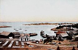
View of the harbor c. 1908
|
|
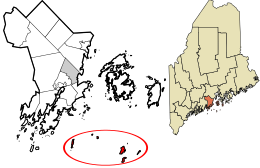
 Location in Knox County and the state of Maine. |
|
| Coordinates: 43°51′40″N 68°53′35″W / 43.86111°N 68.89306°WCoordinates: 43°51′40″N 68°53′35″W / 43.86111°N 68.89306°W | |
| Country | United States |
| State | Maine |
| County | Knox |
| Organized | 1840 |
| Area | |
| • Total | 9.9 sq mi (26 km2) |
| • Land | 2.3 sq mi (6 km2) |
| • Water | 7.6 sq mi (20 km2) |
| Elevation | 0-100 ft (0-30.5 m) |
| Population (2010) | |
| • Total | 74 |
| • Density | 32.2/sq mi (12.3/km2) |
| Time zone | Eastern (EST) (UTC-5) |
| • Summer (DST) | EDT (UTC-4) |
| Zip code | 04851 |
| Area code(s) | 207 |
| FIPS code | 23-44165 |
| GNIS feature ID | 0582584 |
Matinicus Isle is an island plantation in Knox County, Maine, United States. The island is located within Penobscot Bay about 20 miles east of the mainland coast and is accessible by ferry from Rockland or by air taxi from Knox County Regional Airport. The plantation is both a year-round island community and a summer colony. The population was 74 at the 2010 census.
Matinicus is an Abenaki word meaning “far out island.”
The island was probably long used by the indigenous people of North America as a place for hunting and gathering, and Europeans probably started visiting the island in the 16th century. Early documentation of the island comes from John Josselyn‘s 1671 account of New England:
Sagadehock to Nova Scotia is called the Duke of York’s Province. Here Pemaquid, Matinicus, Monhegan, Cape Anawhagen…are all filled with dwelling houses and stages for fisherman, and have plenty of cattle, arable lands and marshes.
The island is also mentioned in the May 1717 deposition of two sailors whose trading ship was commandeered off of Cape Cod by pirates from the ship Whydah. They testified that they were forced to sail north with the pirates, who then took a launch “to Matinicus, where they took a sloop belonging to Colonel [Stephen] Minot, one shallop belonging to Captain [John] Lane and three schooners.” In March 1726, Lieutenant Governor Dummer of the Massachusetts Bay Colony documented the early tension between the Native Americans and Europeans in a letter to Captain John Giles:
...
Wikipedia
