Matobo National Park
| Matobo National Park | |
|---|---|
|
IUCN category II (national park)
|
|

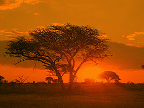
Sunrise in Matobo National Park, 2006
|
|
| Location | Matobo (district), Zimbabwe |
| Nearest city | Bulawayo |
| Coordinates | 20°33′00″S 28°30′29″E / 20.55°S 28.508°ECoordinates: 20°33′00″S 28°30′29″E / 20.55°S 28.508°E |
| Area | 424 km2 (164 sq mi) |
| Established | 1926 |
| Governing body | Zimbabwe Parks and Wildlife Management Authority |
| Official name | Matobo Hills |
| Type | Cultural |
| Criteria | iii, v, vi |
| Designated | 2003 (27th session) |
| Reference no. | 306 |
| State Party | Zimbabwe |
| Region | Africa |
The Matobo National Park forms the core of the Matobo or Matopos Hills, an area of granite kopjes and wooded valleys commencing some 35 kilometres south of Bulawayo, southern Zimbabwe. The hills were formed over 2 billion years ago with granite being forced to the surface, this has eroded to produce smooth "whaleback dwalas" and broken kopjes, strewn with boulders and interspersed with thickets of vegetation. Mzilikazi, founder of the Ndebele nation, gave the area its name, meaning 'Bald Heads'.
The Hills cover an area of about 3100 km², of which 424 km² is National Park, the remainder being largely communal land and a small proportion of commercial farmland. The park extends along the Thuli, Mtshelele, Maleme and Mpopoma river valleys. Part of the national park is set aside as a 100 km² game park, which has been stocked with game including the white rhinoceros. The highest point in the hills is the promontory named Gulati (1549 m) just outside the north-eastern corner of the park.
Administratively, Matobo National Park incorporates the Lake Matopos Recreational Park, being the area around Hazelside, Sandy Spruit and Lake Matopos.
The national park is located within the southern Africa bushveld ecoregion.
The national park is the oldest in Zimbabwe, established in 1926 as Rhodes Matopos National Park, a bequest from Cecil Rhodes. The original park borders extended well to the south and east of the current park. These areas were redesignated for settlement as part of a compromise between the colonial authorities and the local people, creating the Khumalo and Matobo Communal Lands. The park area then increased with the acquisition of World's View and Hazelside farms to the north.
The current name Matobo reflects the correct vernacular pronunciation of the area.
The Matobo Hills were designated as a UNESCO World Heritage Site in 2003. The area "exhibits a profusion of distinctive rock landforms rising above the granite shield that covers much of Zimbabwe".
...
Wikipedia
