McClellan-Palomar Airport
| McClellan–Palomar Airport | |||||||||||
|---|---|---|---|---|---|---|---|---|---|---|---|

FAA airport diagram
|
|||||||||||
| Summary | |||||||||||
| Airport type | Public | ||||||||||
| Owner | County of San Diego | ||||||||||
| Serves | North San Diego County | ||||||||||
| Elevation AMSL | 331 ft / 101 m | ||||||||||
| Coordinates | 33°07′42″N 117°16′48″W / 33.12833°N 117.28000°WCoordinates: 33°07′42″N 117°16′48″W / 33.12833°N 117.28000°W | ||||||||||
| Website | www.sdcounty.ca.gov/.../palomar.html | ||||||||||
| Map | |||||||||||
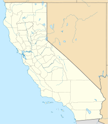
| Location of airport in California | |||||||||||
| Runways | |||||||||||
|
|||||||||||
| Helipads | |||||||||||
|
|||||||||||
| Statistics (2012) | |||||||||||
|
|||||||||||
|
Sources: FAA, airport website
|
|||||||||||
| Aircraft operations | 141,462 |
|---|---|
| Based aircraft | 285 |
McClellan–Palomar Airport (Palomar Airport) (IATA: CLD, ICAO: KCRQ, FAA LID: CRQ) is a public airport three miles (5 km) southeast of Carlsbad in San Diego County, California. It is owned by the County of San Diego. The airport is used for general aviation. In March 2013 the airport was the fourth-busiest single runway airport in the United States.
Most U.S. airports use the same three-letter location identifier for the FAA and IATA, but McClellan–Palomar Airport is CRQ to the FAA and CLD to the IATA. The ICAO identifier is KCRQ.
The airport is named for Gerald McClellan, an aviator and civic leader in San Diego's North County area.
McClellan–Palomar Airport covers 466 acres (189 ha) and has one asphalt runway, 6/24, 4,897 ft × 150 ft (1,493 m × 46 m). The airport also has one asphalt helipad that is 100 by 100 feet (30 x 30 m).
In 2008 the airport had 192,960 aircraft operations, an average of 529 per day: 89% general aviation, 7% air taxi, 3% scheduled commercial and 1% military. 325 aircraft are based at this airport: 61% single-engine, 24% jet, 11% multi-engine and 4% helicopter.
...
Wikipedia

