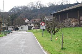
Mellikon
| Mellikon | ||
|---|---|---|
 |
||
|
||
| Coordinates: 47°34′N 8°21′E / 47.567°N 8.350°ECoordinates: 47°34′N 8°21′E / 47.567°N 8.350°E | ||
| Country | Switzerland | |
| Canton | Aargau | |
| District | Zurzach | |
| Area | ||
| • Total | 2.71 km2 (1.05 sq mi) | |
| Elevation | 357 m (1,171 ft) | |
| Population (Dec 2015) | ||
| • Total | 262 | |
| • Density | 97/km2 (250/sq mi) | |
| Postal code | 5465 | |
| SFOS number | 4314 | |
| Surrounded by | Böbikon, Hohentengen am Hochrhein (DE-BW), Küssaberg (DE-BW), Rekingen, Rümikon, Wislikofen | |
| Website |
www SFSO statistics |
|
Mellikon is a municipality in the district of Zurzach in the canton of Aargau in Switzerland.
Mellikon is first mentioned in 1113 as Meliken. The village developed from a farm owned by Zurzach Abbey, but it was only recognized by the Abbey as a municipality in 1661. During the Protestant Reformation, the majority of the population in Mellikon joined the new religion. The Reformed members belonged to the parish of Zurzach, while the Catholic members belonged to the Catholic parish of Zurzach. In 1645 Jost von Roll from Uri built a mansion and Catholic chapel in Mellikon. It still serves as a place of worship and cemetery for the von Roll family. The limestone quarry in the village was used into the 1980s by the Schweiz Sodafabrik and then in the 1990s by the Mellikon AG company. Starting in 1990, an industrial and business park was built west of the village. In 1995, the village was tied into the Swiss Federal Railways Rhine Valley line. The majority of the population is employed outside the village.
Mellikon has an area, as of 2009[update], of 2.71 square kilometers (1.05 sq mi). Of this area, 0.74 km2 (0.29 sq mi) or 27.3% is used for agricultural purposes, while 1.36 km2 (0.53 sq mi) or 50.2% is forested. Of the rest of the land, 0.48 km2 (0.19 sq mi) or 17.7% is settled (buildings or roads), 0.11 km2 (27 acres) or 4.1% is either rivers or lakes.
Of the built up area, industrial buildings made up 3.0% of the total area while housing and buildings made up 1.5% and transportation infrastructure made up 4.4%. Power and water infrastructure as well as other special developed areas made up 8.5% of the area Out of the forested land, 49.1% of the total land area is heavily forested and 1.1% is covered with orchards or small clusters of trees. Of the agricultural land, 17.7% is used for growing crops and 8.9% is pastures. All the water in the municipality is flowing water.
...
Wikipedia


