Miltenberg
| Miltenberg | ||
|---|---|---|

View from the Main of Miltenberg
|
||
|
||
| Coordinates: 49°42′14″N 09°15′52″E / 49.70389°N 9.26444°ECoordinates: 49°42′14″N 09°15′52″E / 49.70389°N 9.26444°E | ||
| Country | Germany | |
| State | Bavaria | |
| Admin. region | Unterfranken | |
| District | Miltenberg | |
| Government | ||
| • Mayor | Helmut Demel (Liberale Miltenberger) | |
| Area | ||
| • Total | 60.18 km2 (23.24 sq mi) | |
| Population (2015-12-31) | ||
| • Total | 9,372 | |
| • Density | 160/km2 (400/sq mi) | |
| Time zone | CET/CEST (UTC+1/+2) | |
| Postal codes | 63897 | |
| Dialling codes | 09371 | |
| Vehicle registration | MIL | |
| Website | www.stadt-miltenberg.de | |
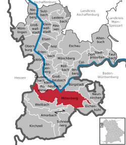
Miltenberg is a town in the Regierungsbezirk of Lower Franconia (Unterfranken) in Bavaria, Germany. It is the seat of the like-named district and has a population of over 9,000.
The old town lies on the Main’s left bank on the "left knee" of the Mainviereck ("Main Square") between the Spessart and Odenwald ranges. Since the Main riverbed in the Miltenberg area is relatively near the foot of the Odenwald, only a narrow strip of usable land is left, little over 150 meters in width, which in past centuries was time and again flooded by the Main. The historic centre, which stands on this land, often sustained considerable damage in these floods. Only in the 21st century efficient flood control measures, most of all a wall, have significantly reduced the adverse effects of these floods. Since about the beginning of the 20th century, after buying land from the neighbouring community of Großheubach, Miltenberg has been expanding on the right bank.
In pre-Roman times, circular ramparts were built on the Greinberg above Miltenberg and on the Bürgstadter Berg (also known as Wannenberg) northeast of Bürgstadt. These were in use as early as the Neolithic (Michelsberg culture) but mostly date from the late Bronze Age (Urnfield culture).
In the 150s, the Roman Empire pushed outwards its fortified border in Germania, establishing the Upper Germanic-Rhaetian Limes which replaced the Odenwald-Neckar-Limes. From Miltenberg on northwards, the river Main became the border. East of Miltenberg a fortified palisade stretched to the south and east towards Walldürn and on to Lorch.
...
Wikipedia


