Miltonsburg, Ohio
| Miltonsburg, Ohio | |
|---|---|
| Village | |

Along Main Street
|
|
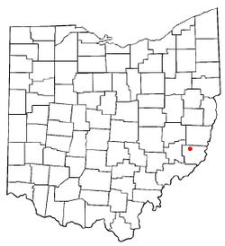
 Location of Miltonsburg, Ohio |
|
 Detailed map of Miltonsburg |
|
| Coordinates: 39°49′53″N 81°10′00″W / 39.83139°N 81.16667°W | |
| Country | United States |
| State | Ohio |
| County | Monroe |
| Township | Malaga |
| Area | |
| • Total | 0.07 sq mi (0.18 km2) |
| • Land | 0.07 sq mi (0.18 km2) |
| • Water | 0 sq mi (0 km2) |
| Elevation | 1,296 ft (395 m) |
| Population (2010) | |
| • Total | 43 |
| • Estimate (2012) | 43 |
| • Density | 614.3/sq mi (237.2/km2) |
| Time zone | Eastern (EST) (UTC-5) |
| • Summer (DST) | EDT (UTC-4) |
| FIPS code | 39-50722 |
| GNIS feature ID | 1051007 |
Miltonsburg is a village in Monroe County, Ohio, United States. The population was 43 at the 2010 census.
Miltonsburg is served by the Monroe County District Library from its administrative offices in Woodsfield.
Miltonsburg is located at 39°49′53″N 81°10′00″W / 39.831350°N 81.166541°WCoordinates: 39°49′53″N 81°10′00″W / 39.831350°N 81.166541°W (39.831350, -81.166541).
According to the United States Census Bureau, the village has a total area of 0.07 square miles (0.18 km2), all of it land.
As of the census of 2010, there were 43 people, 19 households, and 12 families residing in the village. The population density was 614.3 inhabitants per square mile (237.2/km2). There were 25 housing units at an average density of 357.1 per square mile (137.9/km2). The racial makeup of the village was 100.0% White.
...
Wikipedia
