Minturn, Colorado
| Minturn, Colorado | |
|---|---|
| Home rule municipality | |
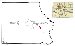
 Location in Eagle County and the state of Colorado |
|
| Coordinates: 39°35′14″N 106°25′47″W / 39.58722°N 106.42972°WCoordinates: 39°35′14″N 106°25′47″W / 39.58722°N 106.42972°W | |
| Country |
|
| State |
|
| County | Eagle |
| Incorporated (town) | November 23, 1904 |
| Government | |
| • Type | Home Rule Municipality |
| • Mayor | Gordon Flaherty |
| Area | |
| • Total | 7.8 sq mi (20.1 km2) |
| • Land | 7.6 sq mi (19.6 km2) |
| • Water | 0.2 sq mi (0.5 km2) |
| Elevation | 7,861 ft (2,396 m) |
| Population (2010) | |
| • Total | 1,027 |
| • Density | 136/sq mi (52.4/km2) |
| Time zone | Mountain (MST) (UTC-7) |
| • Summer (DST) | MDT (UTC-6) |
| ZIP code | 81645 (PO Box) |
| Area code(s) | 970 |
| FIPS code | 08-50920 |
| GNIS feature ID | 0176136 |
| Website | www |
Minturn is a home rule municipality in Eagle County, Colorado, United States. The town population was 1,027 at the 2010 United States Census.
Minturn is located in southeastern Eagle County on the Eagle River between the resort communities of Vail and Beaver Creek. The town limits extend 2 miles (3 km) northwest along U.S. Route 24 to Interstate 70 at Exit 171, from which point it is 5 miles (8 km) east to Vail and 5 miles west to Avon at the base of Beaver Creek Resort. Eagle, the county seat, is 25 miles (40 km) to the west, and Denver is 101 miles (163 km) to the east. US 24 leads south 30 miles (48 km) over the Continental Divide at Tennessee Pass to Leadville.
According to the United States Census Bureau, the town has a total area of 7.8 square miles (20.1 km2), of which 7.6 square miles (19.6 km2) is land and 0.2 square miles (0.5 km2), or 2.32%, is water.
Minturn is surrounded on three sides by White River National Forest, with the Holy Cross Wilderness bordering the southwest side of the town. The national forest offers hiking, biking, snowshoeing, cross country skiing, and other recreational opportunities. Five huts operated by the Tenth Mountain Hut Association along with their associated trail systems are found in the local Eagle-Holy Cross ranger district. Camp Hale, a World War II winter training site now on the National Register of Historic Places, is situated toward the south end of the district.
...
Wikipedia
