Mizoram-Manipur-Kachin rain forests
| Mizoram-Manipur-Kachin rain forests | |
|---|---|

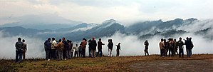
View across the Mizoram-Manipur-Kachin rain forests. This picture is from the Pangsau Pass in the northwest of the ecoregion, on the border between India and Myanmar.
|
|
| Ecology | |
| Biome | subtropical moist broadleaf forest |
| Borders |
|
| Geography | |
| Area | 135,600 km2 (52,400 sq mi) |
| Countries | India, Myanmar and Bangladesh |
| Coordinates | 24°14′N 94°0′E / 24.233°N 94.000°ECoordinates: 24°14′N 94°0′E / 24.233°N 94.000°E |
The Mizoram-Manipur-Kachin rain forests is a subtropical moist broadleaf forest ecoregion which occupies the lower hillsides of the mountainous border region joining India, Bangladesh, and Burma (Myanmar). The ecoregion covers an area of 135,600 square kilometres (52,400 sq mi). Located where the biotas of the Indian Subcontinent and Indochina meet, and in the transition between subtropical and tropical regions of Asia, the Mizoram-Manipur-Kachin rain forests are home to great biodiversity. The WWF rates the ecoregion as "Globally Outstanding" in biological distinctiveness.
The ecoregion is characterised by semi-evergreen rain forest, covering the lower elevations of the Chin Hills-Arakan Yoma in Burma's Arakan State and India's Manipur state and the adjacent Chittagong Hills of Bangladesh, then extending northwards along the Naga Hills and Mizo Hills to cover most of India's Nagaland and Mizoram states, and eastwards across Burma's Sagaing Division and Kachin State to the Burma-China border.
The Burmesian coastal rain forests occupy the coastal lowlands of Burma to the south and southwest. To the west, the ecoregion borders the Meghalaya subtropical forests in southeastern Assam, and the Brahmaputra Valley semi-evergreen forests in the Assamese lowlands. The Mizoram-Manipur-Kachin rain forests extend up to the 1,000 metres (3,300 feet) elevation of the Chin Hills-Arakan Yoma range, and the Chin Hills-Arakan Yoma montane forests occupy the portion of the range above 1,000 metres (3,300 feet). As the Mizoram-Manipur-Kachin forests extend east across Burma, they are bounded by the Irrawaddy moist deciduous forests of the Irrawaddy River basin to the south, and by the higher-elevation Northern Triangle subtropical forests to the north and the Northern Indochina subtropical forests to the east. The Northeast India-Burma pine forests occupy the higher elevations of the Naga Hills along the Nagaland-Burma border, and are surrounded by the Mizoram-Manipur-Kachin rain forests on the west, south and east.
...
Wikipedia
