Montgomery County, Georgia
| Montgomery County, Georgia | |
|---|---|

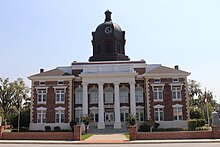
Montgomery County Courthouse (built 1907) in Mount Vernon
|
|
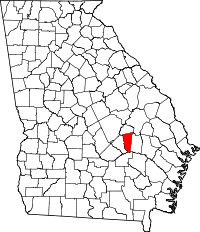
 Location in the U.S. state of Georgia |
|
 Georgia's location in the U.S. |
|
| Founded | December 19, 1793 |
| Named for | Richard Montgomery |
| Seat | Mount Vernon |
| Largest city | Mount Vernon |
| Area | |
| • Total | 245 sq mi (635 km2) |
| • Land | 240 sq mi (622 km2) |
| • Water | 5.2 sq mi (13 km2), 2.1% |
| Population | |
| • (2010) | 9,123 |
| • Density | 38/sq mi (15/km²) |
| Congressional district | 12th |
| Time zone | Eastern: UTC-5/-4 |
| Website | montgomerycountyga |
Montgomery County is a county in the U.S. state of Georgia. As of the 2010 census, the population was 9,123. The county seat is Mount Vernon.
Montgomery County is part of the Vidalia, GA Micropolitan Statistical Area.
Montgomery County is named in honor of Richard Montgomery, an American Revolutionary War general killed in 1775 while attempting to capture Quebec City, Canada. It was created on December 19, 1793 from a southern portion of Washington County, Georgia.
Arthur Lott's Plantation was designated the first county seat in 1797.
In 1801, Tattnall County, Georgia was formed from the southern part of Montgomery County. The dividing line between Tatnall and Montgomery ran from the mouth of Limestone Creek on the Oconee River, just below modern Mount Vernon, Georgia, to the mouth of Wolf Creek on the Canoochee River below Metter, Georgia.
On December 11, 1811, the county lines between Washington County, Montgomery County, and Laurens County were adjusted by the Georgia General Assembly. The northern section of Montgomery between the Oconee River and the Ohoopee River was transferred to Laurens. On December 10, 1812, the county line of Montgomery was significantly adjusted as part of the creation of Emanuel County. Its new boundaries became from the then Laurens and Telfair county line on the Oconee River to the north prong of the Little Ocmulgee River (near present Chauncey, Dodge County, Georgia) down the Little Ocmulgee River as it meanders to its confluence with the Ocmulgee River then downstream as it meanders to the Oconee River, then North 30 degrees to Milligan's Creek in Tatnall County, and then with it to the Montgomery County line. Pendleton Creek (in modern Treutlen and Toombs counties) was used as the border between Montgomery and Emanuel. Because of these transitions Montgomery regained part of the land it had lost in the creation of Tatnall County in 1801 (land along the lower Oconee River), but also lost land along the upper Oconee River to Laurens County.
...
Wikipedia
