Montrose, Kansas
| Montrose, Kansas | |
|---|---|
| Unincorporated community | |
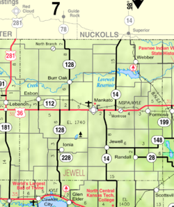
 KDOT map of Jewell County (legend) |
|
| Coordinates: 39°47′4″N 98°5′16″W / 39.78444°N 98.08778°WCoordinates: 39°47′4″N 98°5′16″W / 39.78444°N 98.08778°W | |
| Country | United States |
| State | Kansas |
| County | Jewell |
| Elevation | 1,644 ft (501 m) |
| Time zone | CST (UTC-6) |
| • Summer (DST) | CDT (UTC-5) |
| Area code | 785 |
| FIPS code | 20-48000 |
| GNIS ID | 472005 |
Montrose is an unincorporated community in Jewell County, Kansas, United States.
A post office was first established as Delta in 1880, and it was renamed Montrose in 1888. The origin of the name Montrose is obscure.
...
Wikipedia


