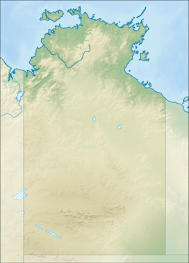
Mount Liebig
| Mount Liebig | |
|---|---|

Viewed from the Gary Junction Road looking east.
|
|
| Highest point | |
| Elevation | 1,274 m (4,180 ft) AHD |
| Coordinates | 23°18′S 131°22′E / 23.300°S 131.367°ECoordinates: 23°18′S 131°22′E / 23.300°S 131.367°E |
| Naming | |
| Etymology | Justus von Liebig |
| Geography | |
| Location | Northern Territory, Australia |
| Parent range | MacDonnell Ranges |
Mount Liebig is a mountain with an elevation of 1,274 metres (4,180 ft) AHD in the southern part of the Northern Territory of Australia. It is one of the highest peaks of the MacDonnell Ranges and was named by the explorer Ernest Giles after the German chemist Justus von Liebig. Nearby settlements include Haasts Bluff.
Notable Indigenous Australians who have lived in the region of Mount Liebig include Indigenous artist Nora Andy Napaltjarri and Ngoia Pollard Napaltjarri.
...
Wikipedia

