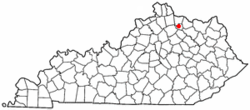
Mount Olivet, Kentucky
| Mount Olivet, Kentucky | |
|---|---|
| City | |

Downtown Mount Olivet
|
|
 Location of Mount Olivet, Kentucky |
|
| Coordinates: 38°31′55″N 84°2′14″W / 38.53194°N 84.03722°WCoordinates: 38°31′55″N 84°2′14″W / 38.53194°N 84.03722°W | |
| Country | United States |
| State | Kentucky |
| County | Robertson |
| Incorporated | December 27, 1851 |
| Reïncorporated | 1871 |
| Named for | the Mount of Olives |
| Area | |
| • Total | 0.4 sq mi (1.0 km2) |
| • Land | 0.4 sq mi (1.0 km2) |
| • Water | 0.0 sq mi (0.0 km2) |
| Elevation | 935 ft (285 m) |
| Population (2010) | |
| • Total | 299 |
| • Density | 751.8/sq mi (290.3/km2) |
| Time zone | Eastern (EST) (UTC-5) |
| • Summer (DST) | EDT (UTC-4) |
| ZIP code | 41064 |
| Area code(s) | 606 |
| FIPS code | 21-53976 |
| GNIS feature ID | 0498801 |
Mount Olivet is a home rule-class city in and the county seat of Robertson County, Kentucky, United States, located at the junction of U.S. Route 62 and Kentucky Route 165. The population was 299 at the 2010 United States census.
The town was founded in 1820 and incorporated in 1851. It became the county seat of Robertson County when that entity was formed in 1867.
Mount Olivet is located at 38°31′55″N 84°2′14″W / 38.53194°N 84.03722°W (38.531827, -84.037167). According to the United States Census Bureau, the city has a total area of 0.4 square miles (1.0 km2), all of it land.
As of the census of 2000, there were 289 people, 130 households, and 73 families residing in the city. The population density was 751.8 people per square mile (293.6/km²). There were 145 housing units at an average density of 377.2 per square mile (147.3/km²). The racial makeup of the city was 97.92% White, 1.38% from other races, and 0.69% from two or more races. Hispanic or Latino of any race were 1.38% of the population.
...
Wikipedia
