Mullaperiyar Dam
| Mullaperiyar Dam | |
|---|---|
 |
|
|
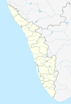
Location of Mullaperiyar Dam in India Kerala
|
|
| Official name | Periyar Dam |
| Country | India |
| Location | Kerala |
| Coordinates | 9°31′43″N 77°8′39″E / 9.52861°N 77.14417°ECoordinates: 9°31′43″N 77°8′39″E / 9.52861°N 77.14417°E |
| Status | Operational |
| Construction began | 1887 |
| Opening date | 1895 |
| Owner(s) | |
| Operator(s) | Tamil Nadu |
| Dam and spillways | |
| Type of dam | Gravity |
| Impounds | Periyar River |
| Height (foundation) | 53.66 m (176 ft) |
| Length | 365.85 m (1,200 ft) (main) |
| Width (crest) | 3.6 m (12 ft) |
| Width (base) | 42.2 m (138 ft) |
| Spillways | 13 |
| Spillway type | Chute |
| Spillway capacity | 3,454.62 cubic metres per second (4,518 cu yd/s) |
| Reservoir | |
| Total capacity | 443,230,000 m3 (359,332 acre·ft) |
| Active capacity | 299,130,000 m3 (242,509 acre·ft) |
| Maximum water depth | 43.281 m (142 ft) |
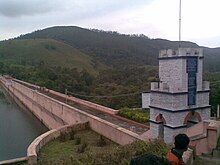
The Mullaperiyar Dam or Mullaiperiyar Dam is a masonry gravity dam on the Periyar River in the Indian state of Kerala It is located 881 m (2,890 ft) above mean sea level, on the Cardamom Hills of the Western Ghats in Thekkady, Idukki District of Kerala, South India. It was constructed between 1887 and 1895 by John Pennycuick and also reached in an agreement to donate water eastwards to the Madras Presidency area (present-day Tamil Nadu). It has a height of 53.6 m (176 ft) from the foundation, and a length of 365.7 m (1,200 ft). The Periyar National Park in Thekkady is located around the dam's reservoir. The dam is located in Kerala on the river Periyar, but is operated and maintained by Tamil Nadu state. Although the Periyar River has a total catchment area of 5398 km2 with 114 km2 in Tamil Nadu, the catchment area of the Mullaperiyar Dam itself lies entirely in Kerala. By reports on 21 November 2014, Mullaperiyar water level touches 142 feet for first time in 35 years.
Earlier known as the Periyar Dam as it was basically meant to dam the Periyar river, the present name Mullaperiyar is derived from a portmanteau of Mullayar River and Periyar River, at the confluence of which the dam is located below.
The Periyar river which flows westward of kerala Arabian sea was diverted eastwards to flow towards the Bay of Bengal to provide water to the arid rain shadow region of Madurai in Madras Presidency which was in dire need of a greater supply of water than the small Vaigai River could provide. The dam created the Periyar Thekkady reservoir, from which water was diverted eastwards via a tunnel to augment the small flow of the Vaigai River. The Vaigai was dammed by the Vaigai Dam to provide a source for irrigating large tracts around Madurai. Initially the dam waters were used only for the irrigation of 68,558 ha (169,411 acres).
...
Wikipedia

