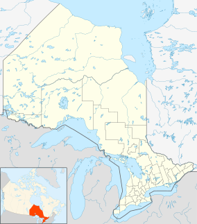
Neys Provincial Park
| Neys Provincial Park | |
|---|---|
|
IUCN category II (national park)
|
|
 |
|
| Location | Thunder Bay District, Ontario, Canada |
| Nearest city | Marathon |
| Coordinates | 48°45′00″N 86°35′00″W / 48.75000°N 86.58333°WCoordinates: 48°45′00″N 86°35′00″W / 48.75000°N 86.58333°W |
| Area | 5,383 ha (13,300 acres) |
| Established | 1965 |
| Governing body | Ontario Parks |
Neys Provincial Park is a Natural Environment Class provincial park on the north shore of Lake Superior, just west of Marathon, Ontario, Canada. This 5,383-hectare (13,300-acre) park includes the historic Coldwell Peninsula and the surrounding island system (added as part of Ontario's Living Legacy in 2000-2001) consisting of Pic Island, Detention Island, and the Sullivan Islands.
The ghost village of Coldwell, which lies just outside the east boundary of the park, was home to an old railway and fishing community until the 1960s. All that remains of the village now are a few foundations, shipwrecks in the harbour and a cemetery. Within park boundaries is also the muse for Group of Seven member Lawren Harris, who in 1924 painted the now famous image of Pic Island. Only the hardy survive here, including subarctic plants and a rare herd of woodland caribou. Enjoy one of the finest beaches on Lake Superior’s north shore or view a model of a former German Prisoner of War Camp at the Neys Visitor Centre.
Neys Provincial Park is home to one of the hardest and rarest mineral complexes in North America. The Coldwell Complex began to form over 1 billion years ago when magma chambers formed beneath the surface causing surface swelling to occur. Eventually this swelling turned into an active volcano. 600 million years ago, the volcano walls became so large and heavy, they caved in on the volcano, acting as a plug. The magma then became trapped in the magma chamber where it settles and cools with other minerals causing the initial phases of the complex. 66 million years ago, glaciers began to recede, stripping away the top layers of the volcano. Today, the once hot magama chamber is exposed surface rock on the northern shore of Lake Superior. The park has an interpretive trail (Under The Volcano Trail) with detailed information plaques that explain the process with more detail.
Lake Superior has been the reason for part of the early cultural heritage of Northern Ontario. It is also the cause of one of the most interesting parts of the natural heritage of the region as well. 7,500 years ago, the large Glaciers of the Laurentide Ice Sheet had finally melted away, filling in large bodies of water that covered 246,050 km². These bodies of water are the Great Lakes. The extremely cold and rough waters of Lake Superior have caused its rocky shores to be home to subarctic plant species. The following is a description of the region from the Natural Heritage Information Centre, Ontario Ministry of Natural Resources:
...
Wikipedia

