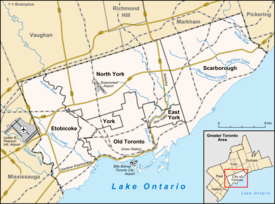
Niagara, Toronto
| Niagara | |
|---|---|
| Neighbourhood | |
 |
|
 Neighbourhood map |
|
| Location within Toronto | |
| Coordinates: 43°38′35″N 79°24′29″W / 43.643°N 79.408°WCoordinates: 43°38′35″N 79°24′29″W / 43.643°N 79.408°W | |
| Country |
|
| Province |
|
| City |
|
| Government | |
| • City Councillor | Mike Layton |
| • Federal M.P. | Adam Vaughan |
| • Provincial M.P.P. | Han Dong |
Niagara is a neighbourhood in Toronto, Ontario, Canada, located south of Queen Street West; it is usually bordered by Strachan Avenue to the west, Bathurst Street to the east, and the railway corridor to the south, and so named because Niagara Street runs through the centre of it. The eastern portion of this area (with what is now called the Fashion District) was first planned as the New Town Extension when Toronto was incorporated as a city. The area was developed as a residential area for the workers of industries located along the CN and CP railway corridors. It remains a working-class neighbourhood that has seen the development of new condominium apartment buildings.
The ten block Town of York (later the St. Lawrence Ward of Toronto) was laid out by Governor Simcoe in 1793 with its southern most street, Palace Street (now Front Street), following the shoreline to the west where it entered Fort York on the west side of the Garrison Creek This original town extended from Jarvis Street to Parliament Street (now Berkeley) with the rest of the area south of Lot Street (now Queen Street) as the 'Garrison Common' (open government land); north of Queen Street were 'farm lots'. North of about Palace Street (Front Street) and Crookshank Lane (Bathurst Street), a burial ground was established for the fort. Just before 1800 the town was extended with a 'New Town' (now the Financial District) in the west using larger lots than in the 'Old Town' and extending from Jarvis Street to Peter Street. There was a military hospital at Niagara Street and Tecumseh across from Fort York.
The 'New Town' grew slowly and it was not until the Town of York was incorporated as the City of Toronto in 1834 that the 'New Town' grid was extended from Peter Street to as far west as the Garrison Creek creating the 'New Town Extension' with its curved Niagara Street, later extended a block closer to the Garrison Creek with Walnut Street. The 'New Town Extension' was planned with a number of squares: Victoria Square, Clarence Square, McDonell Square and West Market Square. In the West Market Square, St. Andrew's Market was established to rival St. Lawrence Market in the 'Old Town' to the east. Between Victoria Square (including the former Garrison Burial Ground and the garrison chapel) at Bathurst Street and Clarence Square at Brock Street (Spadina Avenue) Wellington Street was planned as a broad 'Wellington Place', likely modelled after similar large boulevards in the planned Capital of the United States, Washington which had been burned during the War of 1812 in return for the American occupation of Toronto. Toronto was divided into 'wards' with much of the 'New Town Extension' in St. Andrew's Ward.
...
Wikipedia

