Nikolaevsk, Alaska
| Nikolaevsk, Alaska | |
|---|---|
| CDP | |

Russian Old Believers Church in Nikolaevsk
|
|
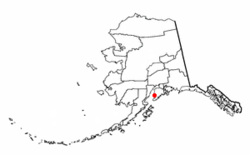
 Location of Nikolaevsk, Alaska |
|
| Coordinates: 59°48′43″N 151°36′36″W / 59.81194°N 151.61000°WCoordinates: 59°48′43″N 151°36′36″W / 59.81194°N 151.61000°W | |
| Country | United States |
| State | Alaska |
| Borough | Kenai Peninsula |
| Government | |
| • Borough mayor | Mike Navarre |
| • State senator | Gary Stevens (R) |
| • State rep. | Paul Seaton (R) |
| Area | |
| • Total | 36.3 sq mi (93.9 km2) |
| • Land | 36.3 sq mi (93.9 km2) |
| • Water | 0.0 sq mi (0.0 km2) |
| Elevation | 840 ft (256 m) |
| Population (2000) | |
| • Total | 345 |
| • Density | 9.5/sq mi (3.7/km2) |
| Time zone | Alaska (AKST) (UTC-9) |
| • Summer (DST) | AKDT (UTC-8) |
| ZIP code | 99556 |
| Area code(s) | 907 |
| FIPS code | 02-54085 |
| GNIS feature ID | 1417063 |
Nikolaevsk (Russian: Николаевск) is a census-designated place (CDP) in Kenai Peninsula Borough in the U.S. state of Alaska. As of the 2010 census, the population of the CDP is 318. Nikolaevsk School serves school-age children from the area.
The town was settled by a group of Old Believers of the Russian Orthodox Old-Rite Church around 1968, and remains a largely ethnic Russian town to this day. The travels of the group from Russia, as well as the story of the founding of Nikolaevsk, is told in a 1972 article in National Geographic. and 2013 episode on the NatGeo channel called 'Red Alaska'.
Nikolaevsk is located at 59°48′47″N 151°40′6″W / 59.81306°N 151.66833°W (59.813043, -151.668387).
According to the United States Census Bureau, the CDP has a total area of 36.3 square miles (94 km2), all of it land. Road access is via the North Fork Road, which junctions with the Sterling Highway 9 miles (14 km) away in Anchor Point.
As of the census of 2000, there were 345 people, 96 households, and 72 families residing in the CDP. The population density was 9.5 people per square mile (3.7/km²). There were 122 housing units at an average density of 3.4/sq mi (1.3/km²). The racial makeup of the CDP was 81.74% White, 1.74% Native American, 0.29% Asian, 1.16% Pacific Islander, 2.03% from other races, and 13.04% from two or more races. 0.29% of the population were Hispanic or Latino of any race.
...
Wikipedia
